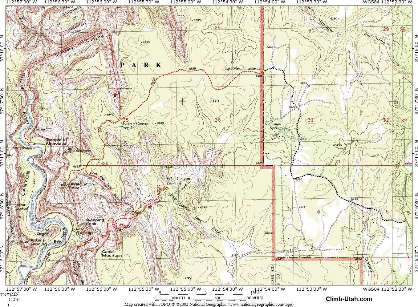
General Information: This route normally requires no swimming, but you will likely encounter at least one pool of waist deep water. You will also be wading down the Virgin River for the last 1/4 mile of this adventure. Wetsuits are normally not used when completing this route. You might want some warm, dry clothes when you complete this canyon so throw a fleece into your drybag. Once you begin descending this canyon please stay in the watercourse and help eliminate the problem of social trails circumventing obstacles. There is no need to leave the watercourse once you begin descending this canyon. The erosion problem created by social trails is a concern to the National Park Service. The watercourse offers more fun and adventure and helps reduce the erosion problem. Please practice responsible canyoneering. Temple of Sinawava is the USGS 7.5 minute topographical map that shows Mystery Canyon. All waypoints and maps for this route use the WGS84 datum. Navigation for this adventure is easy to moderate. Mystery Canyon is rated 3B III using the Canyon Rating System. You will need a Zion backcountry permit to enter Mystery Canyon. Be certain you are entering Mystery Canyon when you leave the East Rim Trail. Mystery Canyon has a mild flashflood danger, but the Zion Narrows has a serious flash flood danger, check the weather report at the Visitor Center when you pick up your permit.
Trailhead Information: From the East Entrance of Zion National Park, drive east 2.4 miles on highway 9. Turn left at the signed "North Fork" junction. Drive 5.2 miles to signed "Zion Ponderosa Resort". Turn left and enter the Zion Ponderosa (N37° 16' 22", W112° 52' 24"). From here, you will be driving on dirt roads. The Zion Ponderosa is private property, please respect this trailhead access. You will be crossing cabin sites with many spur roads, stay on the main road until told to turn off. You will be heading toward the Observation Point Trailhead, sometimes there are signs, other times they have been removed. After entering the Zion Ponderosa, stay on the main road (do not turn left to the resort) and drive 0.7 miles to signed Cable Mountain, Observation Point road fork (N37° 16' 33", W112° 53' 02"). Take the right fork and drive 0.7 miles to a tee in the road (N37° 16' 47", W112° 53' 45"). Turn right, and drive 1.1 miles until road forks around a large ponderosa pine (N37° 17' 43", W112° 53' 49"). Take the right fork and drive 0.2 miles to a spur road on the left (N37° 17' 51", W112° 54' 00"). Take the spur road to the left and drive 0.1 miles. The road ends at a fence, which is the Zion Park boundary. There are no signs at the trailhead (N37° 17' 47", W112° 54' 04"). Cross the fence at the access point 40 feet south and begin walking west on the well-traveled trail. After 20 minutes, you will notice a canyon to the north. This is the South Fork of Orderville Canyon, DO NOT drop in here. This canyon and Mystery Canyon look similar from the top. Continue walking for an additional 20 minutes and you will again notice a canyon to the north with a spur trail leading to the edge. This is Mystery Canyon. Weeping Rock Trail: Take the Zion Canyon Shuttle to Weeping Rock (N37° 16' 16", W112° 56' 18"). Climb the Observation Point trail and take in the view from Observation Point (N37° 16' 41", W112° 56' 25"), it is worth the slight detour. Return to the Observation Point / East Mesa trails junction. From the junction walk east for 20 minutes. You will notice a canyon to the north with a spur trail leading to the edge. This is Mystery Canyon.
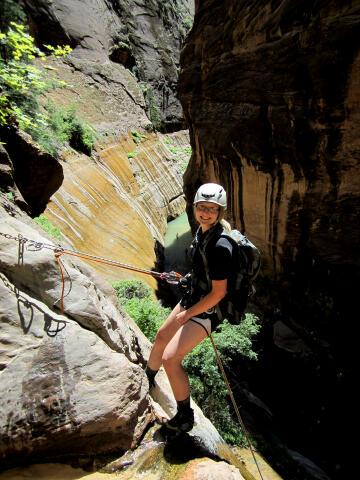
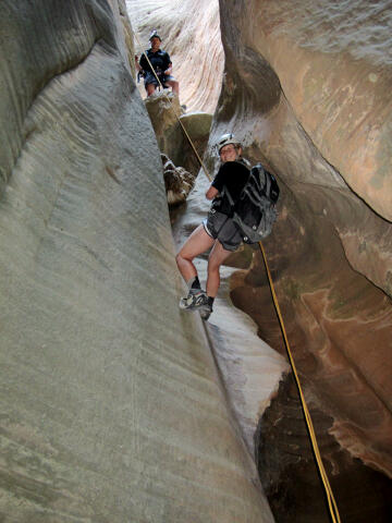
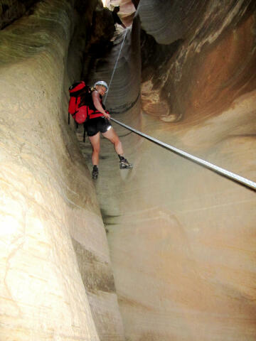
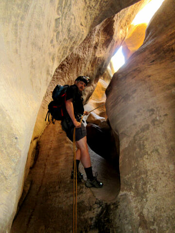
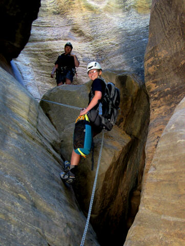
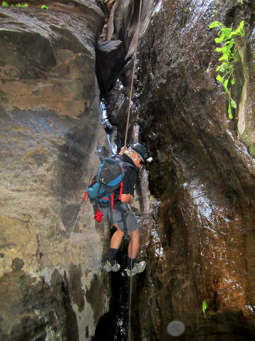
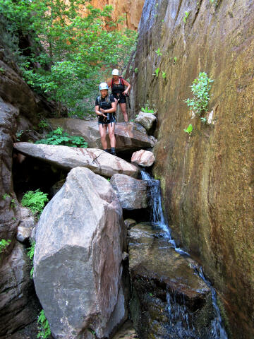
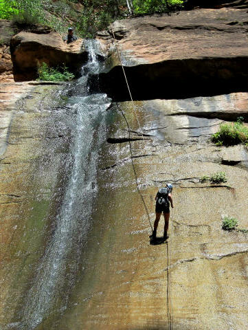
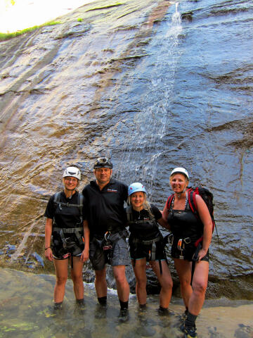
Route Information: From the top of Mystery Canyon (N37° 17' 19", W112° 55' 47") there is a well defined trail that drops steeply down to the floor of the canyon. After reaching the canyon bottom head downstream. It is almost impossible to get lost from this point on. Many of the small obstacles, which you first encounter, were traditionally bypassed by a trail on the right. However, it has recently become more popular to stay in the watercourse and downclimb or rappel all obstacles. As you near the dogleg the canyon really narrows up and forms a great, deep, narrow slot and everyone is forced into the watercourse. At this point you will encounter a 45-foot rappel from a two bolt anchor. Keep your rope out because immediately you are faced with a 35-foot rappel down a chute from a two bolt anchor. Again, keep the rope out because you will immediately encounter a second 40-foot rappel from a two bolt anchor. As this point you should be just above the dogleg. The dogleg is a combination of easy rappels or downclimbs, the choice is yours. All anchors in the section are easy to locate. Just below the dogleg you will encounter a 50-foot rappel followed by a 20-foot rappel, both from bolted anchors. From the bottom of the 20-foot rappel you can put away your rope as you stroll down to the Devils Hole. The Devils Hole was formed by a massive rockslide that you must climb over. Occasionally the Devils Hole is filled with muddy water, which you must wade or swim. After the Devils Hole you will encounter a 50-foot sloping rappel with a two bolt anchor. There is usually water at the bottom of this rappel but it can be avoided with a little effort. The next obstacle and signature feature of Mystery Canyon is the 115-foot rappel into Mystery Springs. The Rappel anchors are located on a narrow ledge to the south (left), use caution reaching these anchors since they are very exposed. Rappel past the massive chokestone into the plunge pool filled with clear, cold water. This pool is normally about waist deep, but it has also been a swimmer in years past. It just depends on what the last flash flood did to the canyon. In an emergency it might be helpful to know that you can walk under the massive chokestone located midway down the rappel, and there is a bolted anchor under the chokestone. This option is usually used when someone drops gear into the pothole located behind the chokestone. Next on the route is a 10-foot drop. Sometimes this drop ends in a pool of water and sometimes not, it just depends on conditions. This drop can be downclimbed on the north (right) side, or a short rappel can be set up for those who desire. Mystery Canyon ends with a spectacular 115-foot rappel into the Zion Narrows. You will be rappelling down a waterfall, which is very slippery with moss, so use caution. If you are lucky, there will be a large crowd of tourists gathered to admire your canyoneering skills and videotape you for future generations to admire. All that remains is to hike down the Narrows to the Temple of Sinawava (N37° 17' 07", W112° 56' 52") and catch the shuttle out of Zion Canyon. If you began this adventure at the East Mesa Trailhead now would be a good time to figure out how you are going to retrieve your wheels.
Full
Meal Deal:
Video:
© Copyright 2000-, Climb-Utah.com |