[
Homepage ] [
Introduction ] [
Warning ] [
Ratings
] [ Ethics ] [
Feedback ] [
Updates ]
 |
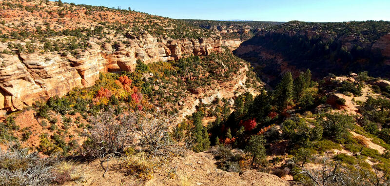
Indian Canyon
South Fork
Hiking &
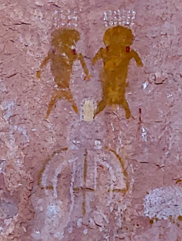
Pictographs
Coral Pink Sand Dunes
The
South Fork of Indian Canyon near Zion National Park contains some great
pictographs. This is a short and fun family friendly hike.
Please take only pictures and leave only footprints. |
General Information:
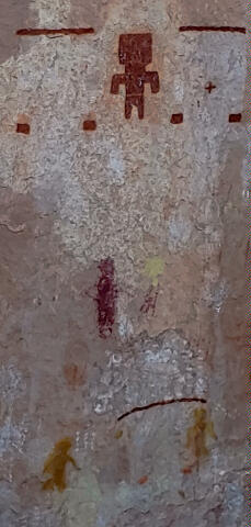
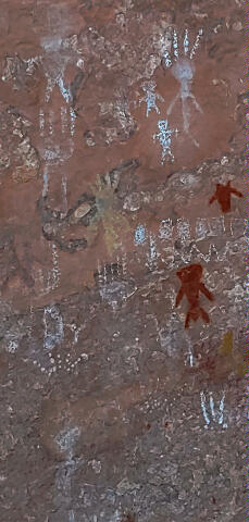
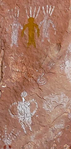
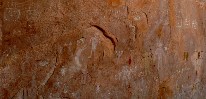
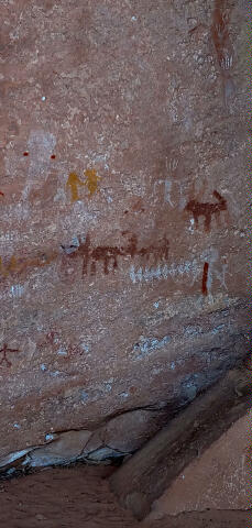
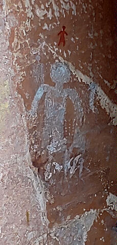
  The South Fork of Indian Canyon contains outstanding pictographs. The
rock art are accessible year round in good weather. Spring and fall are the
ideal times for this hike. The canyon is very hot in summer.
The South Fork of Indian Canyon contains outstanding pictographs. The
rock art are accessible year round in good weather. Spring and fall are the
ideal times for this hike. The canyon is very hot in summer.
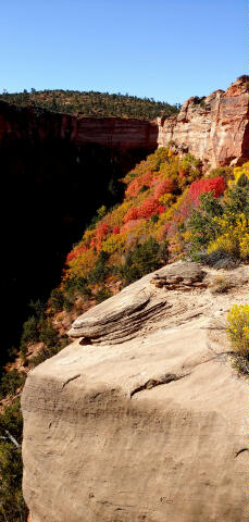
The time required to hike from the
South Fork of Indian Canyon is approximately 1 hour round trip. This is a desert
environment, every member of your hiking party should carry at least one
liter of water.
A GPS is extremely useful in
verifying you are on the correct route and in locating rock art. The USGS 7.5' Map
titled "Yellowjacket Canyon" shows the area
described. Navigation for this route is easy. South Fork of Indian Canyon contains a use trail for
it's entire length, the trail is never very difficult to follow if you pay attention. All
waypoints and maps use the WGS84 datum. South Fork of Indian Canyon is rated 1A I using the Canyon
Rating System.
From Mount Carmel
Junction:
Travel south on Highway 89 for 9.2 miles to a junction with
Hancock Road heading west (right).
From Kanab:
From Main Street and Highway 89 follow Highway 89 west and
than north for 7.8 miles to a junction with Hancock Road heading west
(left).
From Hancock Road:
The South Fork of
Indian Canyon is
accessible to all vehicles in good weather. Those with two-wheel drive will
probably be forced to hike the final 1.7 miles to the actual trailhead.
Those with four-wheel drive should have no issues with driving to the actual
trailhead.
From the junction of
Hancock Road and Highway 89 (N37° 09' 49",
W112° 34' 08"), follow Hancock Road west for 5.7
miles to Sand Springs Road (N37° 05' 51", W112° 38' 44").
Turn south (left) on Sand Springs Road and follow it for 3.4 miles to a 4x4
road (N37° 03' 30", W112° 40' 41") on
the east (left). Two wheel drive vehicles can usually make it to this point
with little problem. If you have a two-wheel drive vehicle you can walk from
here. If you have a four-wheel drive vehicle follow the 4x4 road east for
1.7 miles to the Cul-de-sac Trailhead.
Route Information:
From
the Cul-de-sac Trailhead (N37° 03' 56", W112° 39' 08"), follow the trail
northeast through the sand. The trail is a gradual descent as it drops into
Indian Canyon. After a drop through a section of rocks the trail switchbacks
to the northwest and continues along the hillside beneath the cliff band on
on the south. After hiking 1/2 mile, and descending 150-feet, you will
arrive at the South Fork Indian Canyon Pictographs (N37° 04 01", W112° 39'
00") located in the back of a large alcove. The pictographs are easy to
locate as the are protected by a fence.
Please take only pictures and leave only
footprints.
[
Homepage
] [ Introduction ] [
Warning ] [
Ratings ] [
Ethics
] [ Feedback ] [
Updates ]
© Copyright
2000-, Climb-Utah.com |