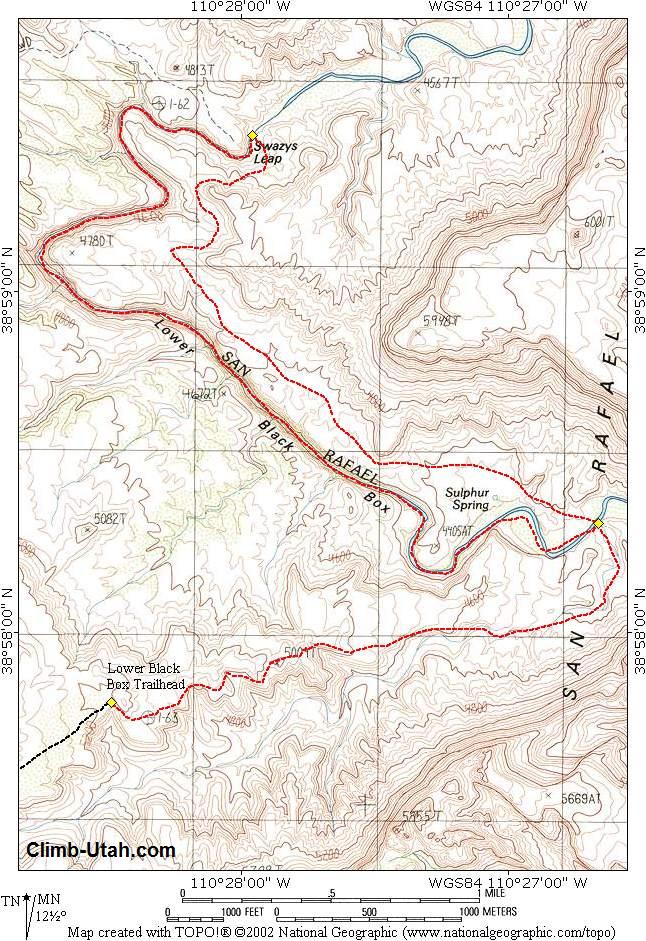
Swaseys Leap, shown on USGS maps as Swazys Leap, is named after Sid Swasey. Local legend has it that Sid bet his brother Joe that he could jump the gap on his saddle horse. According to the legend, Sid made the jump and won a herd of sheep from his brother. Several years later, Sheepherder Paul Hanson built a log bridge across Swaseys Leap for the purpose of getting his sheep across the flooded river. The log bridge fell into the river in 1997. General Information: You should carry a 50-foot length of webbing or rope for emergencies. Many people use an inflated inner tube to float through the deep-water sections of the Lower Black Box. I have never tried using an inner tube, but it could be fun. For floatation I have always placed drybags in my backpack and used it as a float when required. I will also suggest that you carry 3 liters of drinking water per person. The water in the San Rafael Swell is heavily mineralized and works as a laxative, even after being filtered. A GPS is
useful in identifying the correct trailhead and checking that you are on course.
Navigation for this route is easy. Good map reading skills and the USGS 7.5' Map titled
"Spotted Wolf Canyon" are essential.
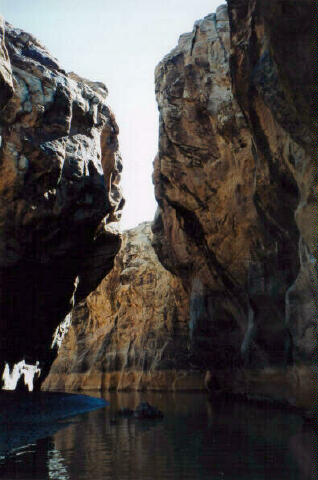
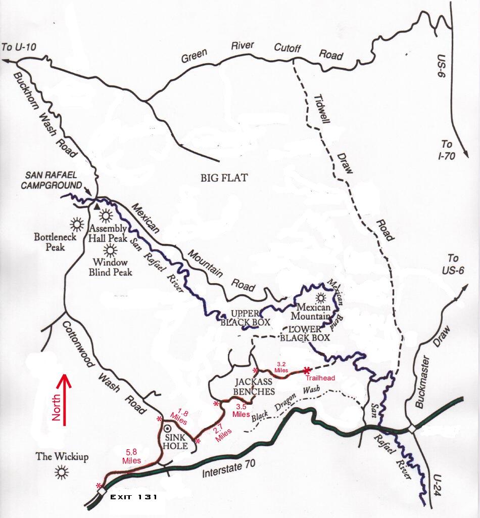
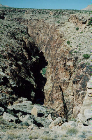
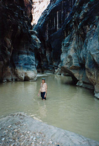
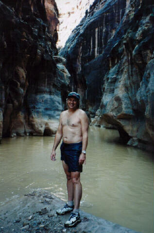
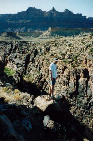
From Green River Utah drive west 29 miles to Ranch Exit #131. The San Rafael Swell is criss-crossed with roads. Stay on the road described until told to turn off of it. Drive north 5.8 miles on the well-maintained dirt Cottonwood Wash road to Sink Hole Flat. Turn right (east) at tee and drive 1.8 miles. Turn left (northeast) at tee and drive 2.7 miles. Turn right (east) at tee and drive 3.5 miles. Turn right (east) at tee and drive 3.2 miles to the trailhead. The final 3 miles to the trailhead requires a high clearance vehicle or 4-wheel drive. The Trailhead consists of a log barrier across the old Sulphur Springs 4-wheel drive road. Route Information: After a short time of hiking northwest you should find a hiker-made trail that follows the bench above the river. It is an enjoyable 2.8 miles from the San Rafael River crossing to Swaseys Leap (N38 59' 27", W110 27' 57"). There are several viewpoints along this trail where you can look into the Lower Black Box. Several hundred yards east from Swaseys Leap the trail descends to the river. Jump in and begin hiking downstream. It is nearly four miles of strenuous river hiking until you reach the exit. There is no trail through the Lower Black Box; you are walking in the river. The river is usually muddy and you will be walking over submerged rocks. In many places the canyon floor is filled with water and swimming or floating across deep pools is necessary. In several places it is necessary to scramble over rock falls. Warning: Flash flood potential is very high. Once you enter the Black Box it is difficult to turn around or escape. Hypothermia is a serious possibility in cool weather.
Related Links: [ Homepage ] [ Introduction ] [ Warning ] [ Ratings ] [ Ethics ] [ Feedback ] [ Updates ] © Copyright 2000-, Climb-Utah.com |