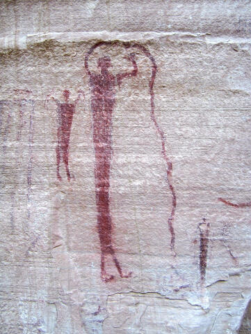
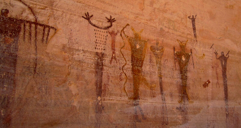
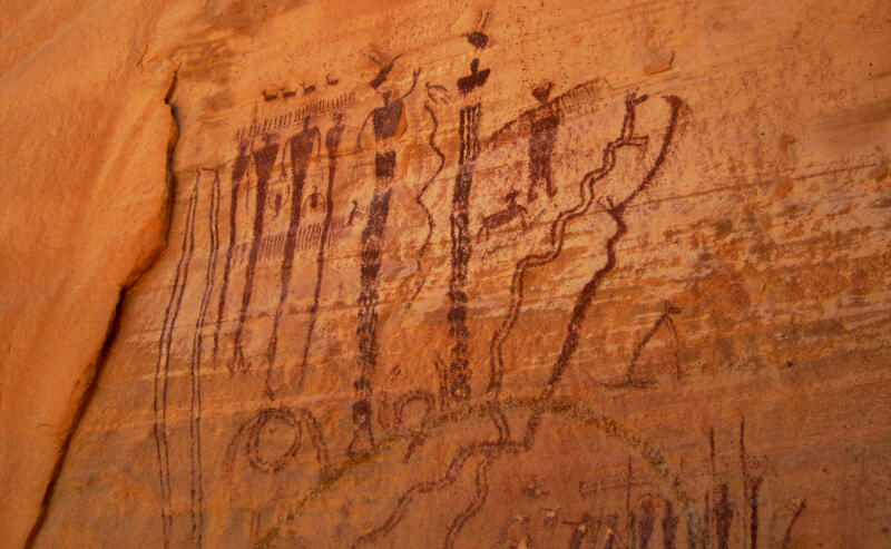
 The main panel of rock art is over
130-feet long and was painted well over 2,000 years ago by the Indian
culture archeologists have named “Barrier Canyon Culture”. The Barrier
Canyon people were an archaic age hunter-gatherer society, living in caves
or brush shelters. The red pigment was created using powdered hematite, and
possibly mixed with animal fat, eggs, or some other fluid. For a brush, they
may have used fingers or brushes made from animal fur or slender grasses.
When painted on freshly exposed sandstone, the stone absorbs the pigments,
thus preserving them for thousands of years. The images here are
fascinating, and defy interpretation.
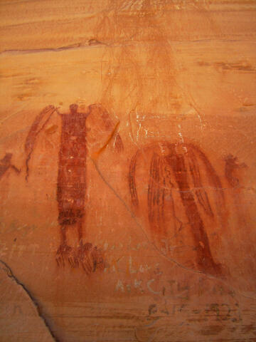
The main panel of rock art is over
130-feet long and was painted well over 2,000 years ago by the Indian
culture archeologists have named “Barrier Canyon Culture”. The Barrier
Canyon people were an archaic age hunter-gatherer society, living in caves
or brush shelters. The red pigment was created using powdered hematite, and
possibly mixed with animal fat, eggs, or some other fluid. For a brush, they
may have used fingers or brushes made from animal fur or slender grasses.
When painted on freshly exposed sandstone, the stone absorbs the pigments,
thus preserving them for thousands of years. The images here are
fascinating, and defy interpretation.
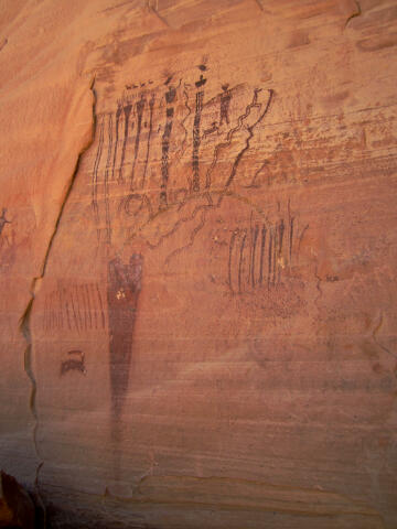
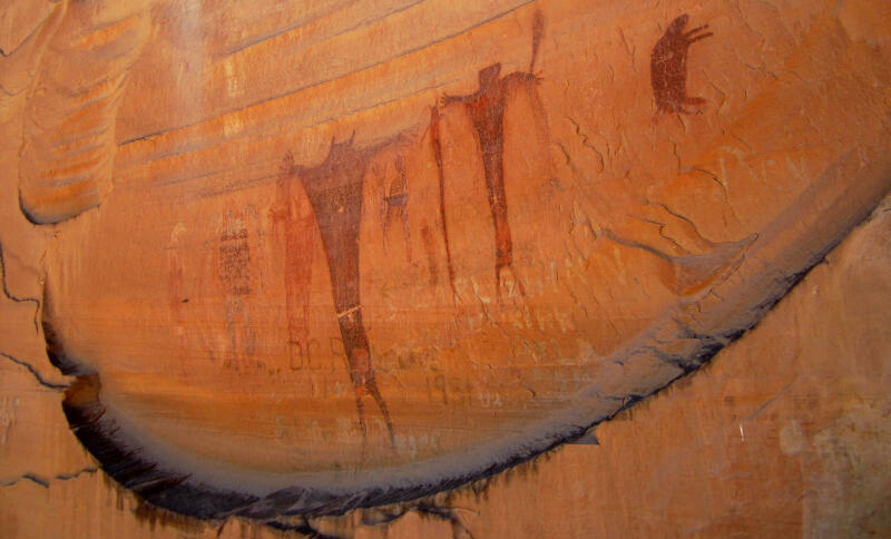
The route up Buckhorn Draw was part of the Old Spanish Trail. As a result of
the relatively large number of people passing by, the panel was repeatedly
vandalized and marked with graffiti over the years. In 1996 the State of
Utah and Emery County restored the panel as part of the state's centennial
celebration.
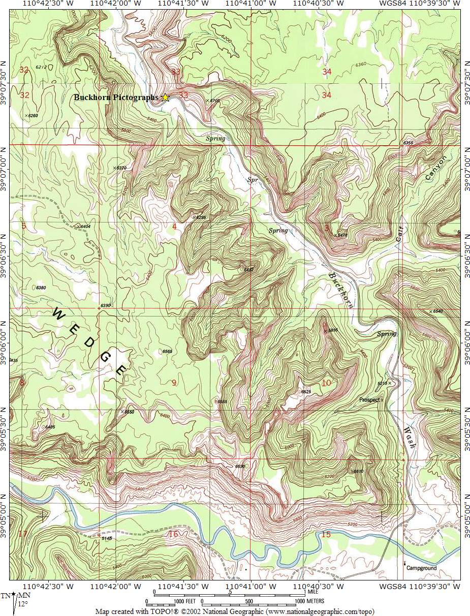
The trailhead is accessible to all vehicles in normal conditions. This area is criss-crossed with roads. Stay on the road described until told to turn off of it. From Price Utah - Take Highway 6 Exit #241 and drive south on Highway 10 for 28 miles to mile marker 39.5, where you will find a well maintained gravel road on the east (left) side of the road. This is where you enter the San Rafael Swell. From Castle Dale Utah - Take Highway 10 north for 1.5 miles to mile marker 39.5, where you will find a well maintained gravel road on the east (right) side of the road. This is where you enter the San Rafael Swell. From where you enter the San Rafael Swell (N39° 13' 15", W110 ° 59' 51") follow the well maintained gravel road east. The road is signed Buckhorn Wash. Follow the road east for 15.1 miles to the signed Buckhorn Wash turnoff (N39° 10' 15", W110 ° 45' 03"). Turn south (right) and follow the Buckhorn Wash road south for 5.8 miles to the Buckhorn Wash Pictographs (N39° 07' 25", W110 ° 41' 38"). The rock are is located on the north (left) side of the road and are easy to located. There is a large parking area, toilets and information kiosks. For those wanting to camp in the area continue down the Buckhorn Wash Road an additional 3.8 miles to the San Rafael River Campground (N39° 04' 58", W110 ° 39' 52").
Route
Information:
Please take only pictures and leave only footprints.
© Copyright 2000-, Climb-Utah.com |