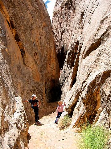
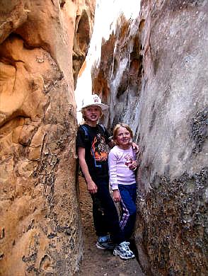
 Headquarters Canyon is a
route the entire family can enjoy. This canyon is often combined with Surprise Canyon to create an enjoyable half-day adventure. The
canyon contains no serious obstacles and is suitable for small children. Normally the
canyon is dry but you could encounter a small amount of wading if it has been raining
heavily in the area.
Headquarters Canyon is a
route the entire family can enjoy. This canyon is often combined with Surprise Canyon to create an enjoyable half-day adventure. The
canyon contains no serious obstacles and is suitable for small children. Normally the
canyon is dry but you could encounter a small amount of wading if it has been raining
heavily in the area.
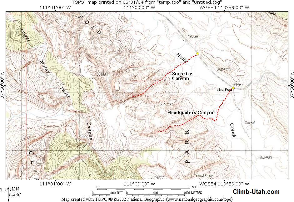
Total time required for a round trip is 1 to 2 hours. A vehicle shuttle is not required for this out and back route. Navigation for this route is easy. A GPS is a waste of good batteries. The USGS 7.5' Map titled "The Post" shows the area of interest. Portions of the route are marked with cairns (small stacks of rocks) to help guide hikers in areas that might be confusing. Headquarters Canyon is rated 1A I using the Canyon Rating System. This canyon has a minor flashflood danger, check the local weather report before entering this canyon.
Trailhead
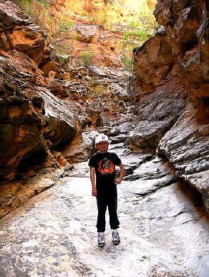
Information: From the Capitol Reef Visitor Center take Highway 24 east for 9.1 miles to mile marker 88.9 and the signed Notom-Bullfrog turn-off. Turn south at the intersection and follow the Notom-Bullfrog Road for 33.2 to the signed Burr Tail Junction. The Notom-Bullfrog road is paved for the first 10.3 miles to the Wayne County line. The remainder of the road is a well-maintained gravel road. At the Burr Tail Junction the road heading west (right) leads to Boulder and Escalante. The road heading south (straight ahead) leads to Bullfrog Marina on Lake Powell. Follow the road south towards Bullfrog Marina for 2.3 miles to a junction. This is known as "The Post" to those familiar with the area and is also the trailhead for Headquarters Canyon. The trailhead is identified by parking for 4 vehicles on the east side of the road. A sign on the west side of the road, across from the parking area, points towards Headquarters Canyon. Route Information:From the Headquarters Canyon Trailhead (N37° 49' 59", W110° 58' 54") begin hiking west and follow the trail towards the reef. Shortly you will encounter a shallow wash that is marked with rock cairns. Follow the wash north, then west into the reef. After turning west, it will not be long before you enter the sheer Navajo Sandstone walls of the canyon, which is guarded by a short, narrow "slot canyon" less than 3 feet wide. Once past this slot, the canyon continues a short distance then soon ends at an interesting Kayenta slickrock slab. You can scramble up the slab until reaching a 6-foot dryfall. Hikers will turn back at this point. Return the same way you came. Experienced canyoneers can continue up canyon by climbing over or around the dryfall. It is possible to climb to the head of the canyon but it requires class 3-4 climbing. © Copyright 2000-, Climb-Utah.com |