[ Homepage ] [ Introduction ] [ Warning ] [ Ratings
] [ Ethics ] [ Feedback ] [ Updates
]
 |
Halls Creek Narrows
Capitol Reef National Park
Canyoneering
Halls
Creek Narrows
is a remote hike or backpack. The route detailed below uses what some
refer to as "The Short Cut" and makes day hiking the route a reasonable
affair for experienced hikers.
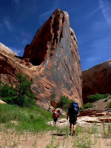
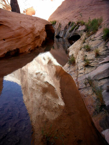
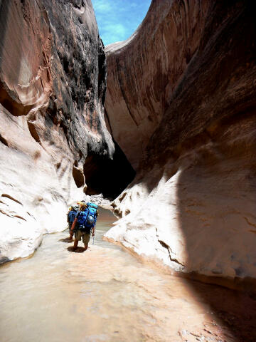
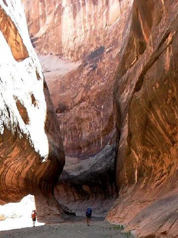
The Halls Creek drainage is a large beautiful canyon bordered by the
high cliffs of Hall Mesa on the east and the steep slickrock slopes of
the Waterpocket Fold on the west. The highlight of the hike is a classic
4-mile long section of slot canyon deeply incised into the white Navajo
sandstone. A trickling perennial stream and deep shade from the arching
canyon walls create a cool, moist oasis in the midst of the surrounding
desert. |
General Information:
 Halls Creek Narrows is a canyoneering hike or
backpack. The canyon is rated 2B III using the canyon
rating system.
The Halls Creek Narrows will require approximately 9 to 10
hours to complete. This route is not a good choice for novice hikers or
children. Spring and fall are the preferred times of year to complete this
hike. The route is brutally hot in summer.
Halls Creek Narrows is a canyoneering hike or
backpack. The canyon is rated 2B III using the canyon
rating system.
The Halls Creek Narrows will require approximately 9 to 10
hours to complete. This route is not a good choice for novice hikers or
children. Spring and fall are the preferred times of year to complete this
hike. The route is brutally hot in summer.
Backcountry group size cannot exceed twelve people. If you plan to make this
an overnight backpack, you need to obtain a free backcountry permit at the
Capitol Reef Visitor Center prior to your trip.
Keep a careful watch as there
is some minor patches of
poison ivy along the route. Navigation for this route
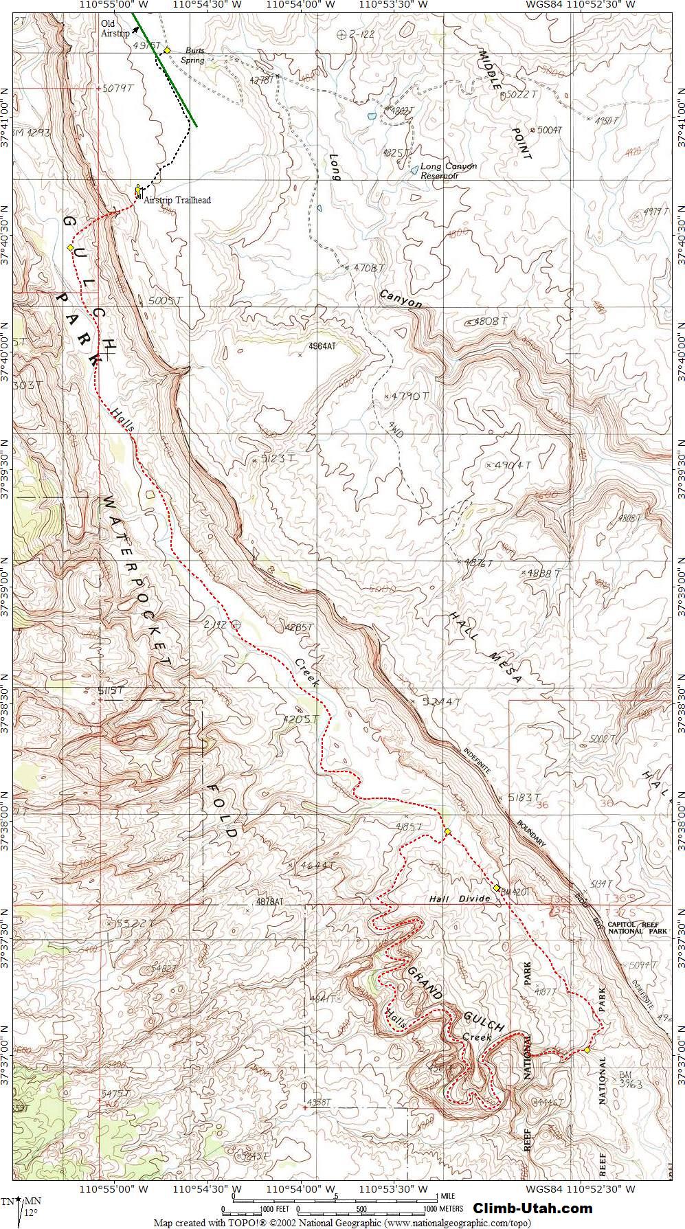
is moderate; a GPS is useful. Good map reading skills and the
USGS 7.5' Maps titled "Deer Point" and "Stevens Canyon North"
are essential. All waypoints and maps use the WGS84 datum. The route down
Halls Creek follows a combination of game trails, old wagon road and
streambed.
This canyon has a
moderate flash flood danger. Use caution in slot canyons; particularly
during the flash flood season (typically July-September). Check the local
weather report before committing.
 |
 |
Trailhead Information:
Halls Creek Narrows does not
require a vehicle shuttle. The trailhead is accessible to passenger cars in
normal conditions. This area is criss-crossed with roads. Stay on the road described
until told to turn off of it. Not all roads described are shown on the USGS
map.
From Ticaboo, Utah drive
south on Highway 276 for 7.0 miles to a junction with the paved Burr Trail
Road (N37° 34' 32", W110° 42' 43). Turn west (right) on to the paved Burr
Trail Road. Follow the paved Burr Trail Road 18.5 miles to a dirt road and a
small wood sign that reads "Halls Creek Overlook" (N37° 44' 47", W110 ° 54'
33"). Turn west (Left) and follow the dirt road 5.0 miles to a junction
(N37° 41' 17", W110° 54' 43"). Turn west (right) and follow the dirt road
0.4 to a bend in the road (N37° 40' 59", W110° 54' 35"). passenger cars
might want to park here. Those with a high clearance vehicle keep following the
dirt road to the west 0.6 miles to the Airstrip Trailhead. There is no
water at the Trailhead. The first pumpable water is 5.0 miles down Halls
Creek in the Halls Creek Narrows.
Some refer to the Airstrip Trailhead as the "Short Cut", this is because the
Halls Creek Narrows route suggested by the National Park Service begins at the Halls
Creek Overlook. The Short Cut trims over 5-miles of slogging off your route
in both directions. The penalty for taking the Short Cut is the route from
canyon rim to canyon floor requires moderate route finding skills.
Route Information:
From the
Airstrip Trailhead (N37° 40' 41", W110° 54' 53) hike west and down to the obvious
break in the cliff band. Work your way through the cliff band and start
descending the steep exposed drainage, trending to your south (left) to
avoid the cliffs below you. Do not under estimate this descent. It is steep
and loose, finishing 1000-feet below you on a game trail (N37° 40' 27", W110°
55' 14"). Turn south (left) on the game trail and follow it for 4 miles
to the start of the Halls Creek Narrows (N37° 37' 58", W110° 53' 13").
At Halls Creek Narrows the trail (old wagon road) continues south over Halls
Divide, but you want to follow the stream as it abandons its logical path
and cuts into the Navajo sandstone on the west (right) side of the canyon.
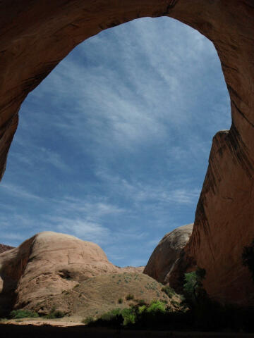
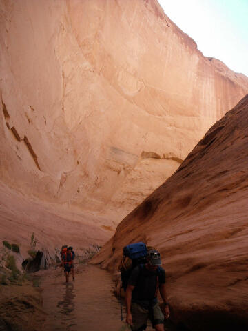
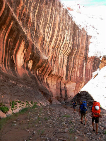
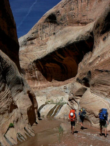
The entrance to the narrows is sudden and dramatic. A large grove of
cottonwood trees is located near the entrance to the narrows. For nearly the
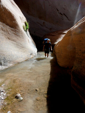
next 4-miles the creek meanders through a deep, narrow canyon that always
requires walking in water and some wading. The depth of the pools can vary
greatly from year to year and from season to season. Flash floods
periodically scour out the sediment, leaving pools that may require deep
wading or short swims.
After hiking through the narrows the stream will rejoin the
trail (N37° 37' 01", W110° 52' 28") you were hiking on originally. At this
point you have a choice. You can return through the narrows, but the fastest
and more common route is to follow the trail (old wagon road) north as it
climbs to the top Halls Divide (N37° 37' 43", W110° 52' 57") and descents
the other side. This should put you back at the beginning of the narrows.
Climbing over Halls Divide eliminates 2 1/2 miles of hiking. Return the way
you came to the Airstrip Trailhead.
History:
In late 1879 the Mormon Hole-in-the-Rock expedition
camped near Dance Hall Rock waiting for the development of a safe crossing
for the nearby Colorado river. Charles Hall was an important part of this
expedition. He stayed on at the Hole-in-the-Rock crossing hoping to make it
an important one for emigrants and freighters traveling both ways across the
river. The Hole-in-the-Rock crossing was used for more than a year until the
travel began to decline. Hall then developed a better crossing some thirty
miles upriver at what is today known as Halls Crossing. He settled at the
mouth of Halls Creek in 1882 and ran a ferry crossing the Colorado River.
Hall also built a wagon road down Halls Creek to his ferry at Halls
Crossing. The old wagon road is now part of the trail you will be hiking
along.
[ Homepage
] [ Introduction ] [ Warning ] [ Ratings ] [ Ethics
] [ Feedback ] [ Updates ]
© Copyright
2000-, Climb-Utah.com |