 The Frying Pan is an
enjoyable hike that will take about 5 hours to complete if you explore all overlooks and
spur tails. The route is accessible year round but I would not do the hike in summer
because it would be miserably hot. You might experience snow on the route in winter. The
route is a well-maintained and easy to follow trail. The route is approximately 7 miles in
length if you explore all overlooks and spur tails. Everyone in your party should carry
two to three liters of water minimum.
The Frying Pan is an
enjoyable hike that will take about 5 hours to complete if you explore all overlooks and
spur tails. The route is accessible year round but I would not do the hike in summer
because it would be miserably hot. You might experience snow on the route in winter. The
route is a well-maintained and easy to follow trail. The route is approximately 7 miles in
length if you explore all overlooks and spur tails. Everyone in your party should carry
two to three liters of water minimum.The Frying Pan requires no special gear other than comfortable hiking shoes. This route is novice friendly and navigation is easy. A GPS is not required to complete this hike, but the coordinates are provided for anyone who is a gadget junkie. Map reading skills and the USGS 7.5' Map titled "Fruita" are useful. The route begins at the Cohab Canyon Trailhead and Ends at the Grand Wash Trailhead. A 3.4 mile vehicle or bicycle shuttle is required to complete this adventure. Grand Wash is a popular trailhead and it is often possible to hitch a ride back to the Cohab Canyon Trailhead. A large easy to read sign saying "campground" will make hitching a ride much easier. The Frying Pan Trail route can be completed in either direction. The direction described here is north to south.
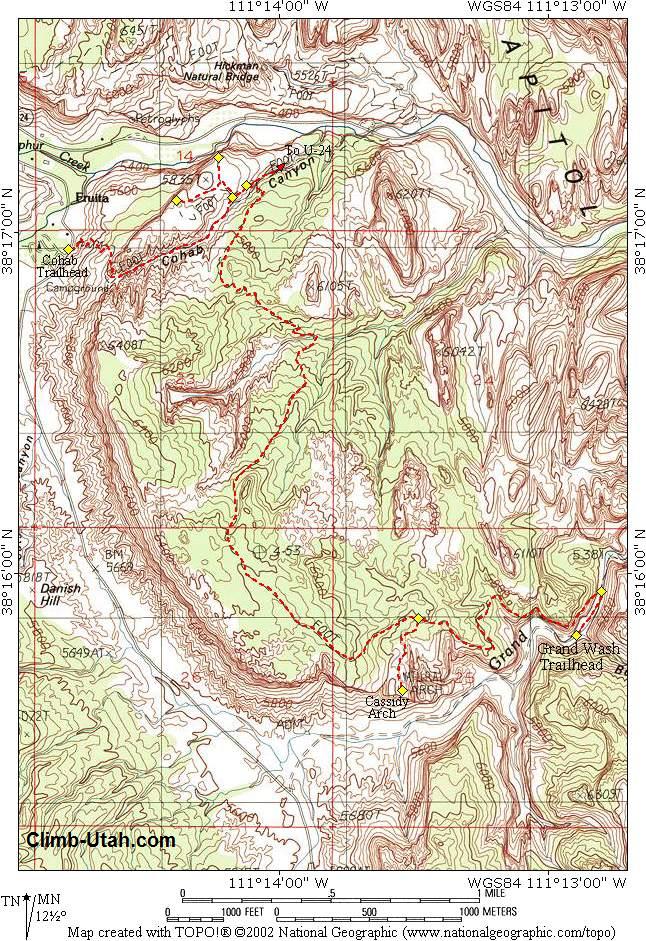
From the Capitol Reef Visitor Center follow the paved Scenic Drive south into the park for 1.2. The signed trailhead is located on the east side of the road. There is no parking at the trailhead. There are two places to park in the area. Backtrack 200 yards and park at the Chestnut picnic area on the east side of the road. Parking is also available at the amphitheater located in the campground. The road to this trailhead is paved. Grand Wash Trailhead: From the Capitol Reef Visitor Center follow the paved Scenic Drive south into the park for 3.4 miles to the signed Grand Wash turn-off located on the east side of the road. Turn onto the well-maintained gravel Grand Wash Road and follow it northeast for 1.2 miles as it cuts into the reef. The road ends at a parking area. This is the trailhead. All vehicles can reach this trailhead in good weather.
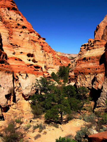
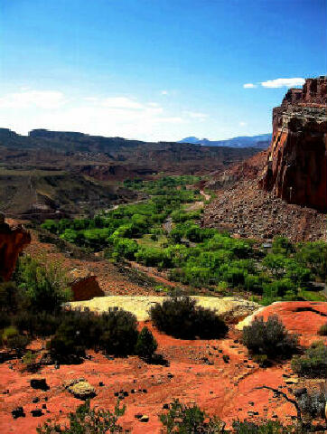
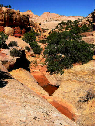
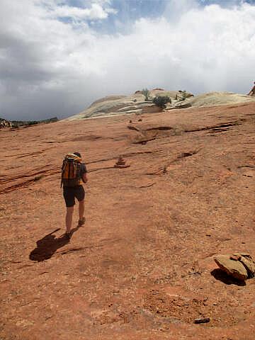
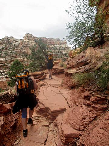
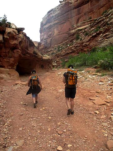
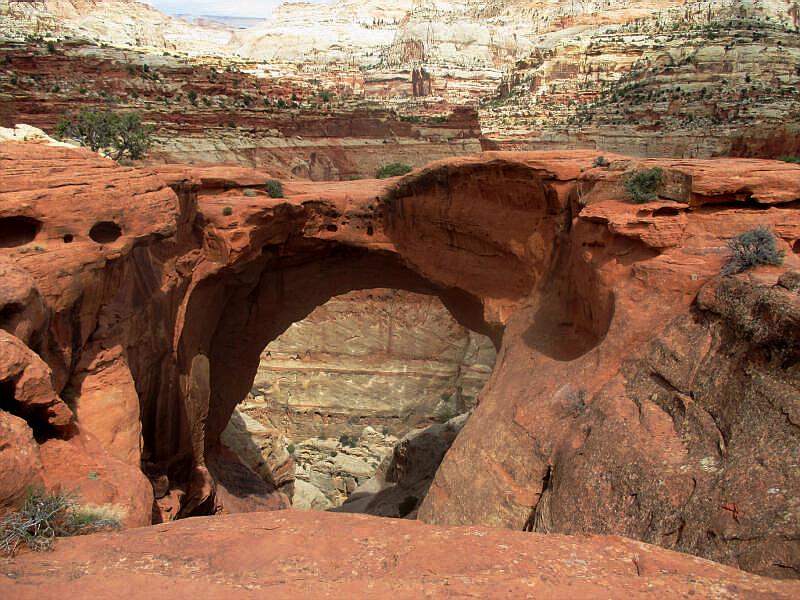
From the Cohab Canyon Trailhead (N38° 16' 58", W111° 14' 46") the route heads east by switchbacking up the clay bentonite mounds of the Chinle formation. 1/4 mile from the trailhead the route reaches the entrance to hidden Cohab Canyon and begins a gradual descent of the shallow, hanging canyon. 1 mile from the trailhead you will encounter a signed trail junction (N38° 17' 06", W111° 14' 11") designating the way north to two canyon overlooks. You can follow the overlook trail to two vantage points high above the Fremont River and Fruita. The North Overlook (N38° 17' 13", W111° 14' 14") is 1/4 mile from the junction and overlooks the Fremont River. The South Overlook (N38° 17' 06", W111° 14' 23") is 1/2 mile from the junction and overlooks the old pioneer town of Fruita. Visiting both overlooks requires approximately 30 to 45 minutes. When you are finished with the overlooks, backtrack to the overlook junction. Continue down Cohab Canyon for 100 yards to a second signed trail junction (N38° 17' 08", W111° 14' 08"). The sign indicates Highway 24 to the east (left) and the Frying Pan Trail to the west (right). Take the Frying Pan Trail, which leads south toward Cassidy Arch and Grand Wash. The Frying Pan Trail snakes over a serpentine route along the top of the Waterpocket Fold, winding through mounds of sandstone and around gullies. In places cairns (stacks of rocks) identify the route. 2 1/2 miles from the trail junction in Cohab Canyon you will encounter the signed spur trail (N38° 15' 52", W111° 13' 29") to Cassidy Arch. Follow the short spur trail 1/4 mile over slickrock to the imposing Cassidy Arch (N38° 15' 40", W111° 13' 33"). The arch was named after the outlaw, Butch Cassidy. After visiting the arch backtrack to the Frying Pan Trail and continue south from the Cassidy Arch junction another 1 mile before reaching the bottom of Grand Wash (N38° 15' 57", W111° 12' 48"). From the bottom of Grand Wash turn west (right) and hike an additional 1/4 mile to the end of the route at the Grand Wash Trailhead (N38° 15' 49", W111° 12' 54").
History:
© Copyright 2000-, Climb-Utah.com |