 The
Black Hole of White Canyon is a semi-technical canyoneering adventure. This route
will require 5 to 6 hours to complete with a shuttle vehicle, add about 45 minutes without
a shuttle. A 60-foot rope is useful for handlines, lowering packs and emergency use.
Novice canyoneers or those with poor downclimbing skills will need to
rappel a couple of short drops, all less than 15-feet high. The
Black Hole of White Canyon is a semi-technical canyoneering adventure. This route
will require 5 to 6 hours to complete with a shuttle vehicle, add about 45 minutes without
a shuttle. A 60-foot rope is useful for handlines, lowering packs and emergency use.
Novice canyoneers or those with poor downclimbing skills will need to
rappel a couple of short drops, all less than 15-feet high.
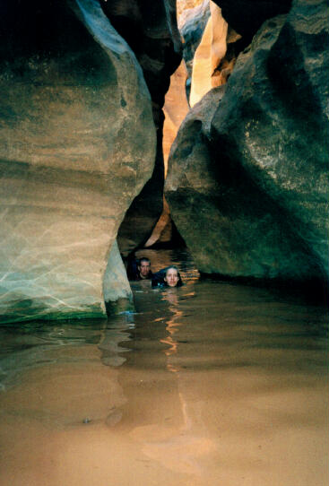
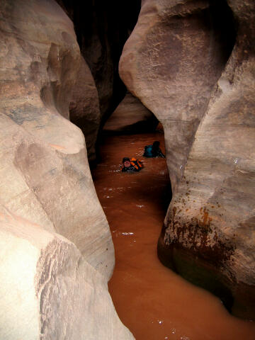
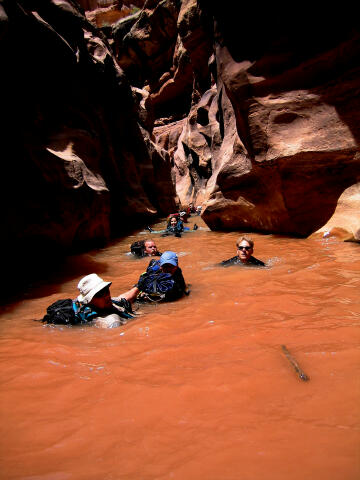
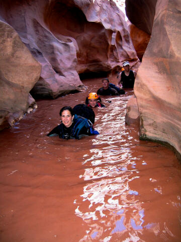
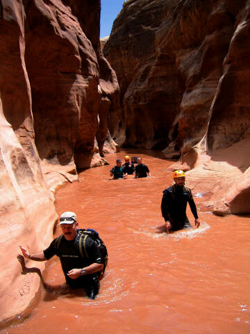
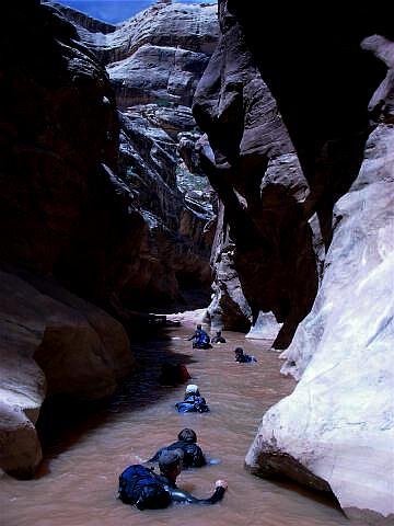
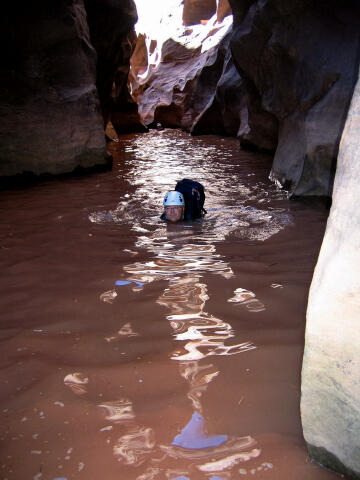
The Black Hole contains several very long and cold swims. Wetsuits are suggested in all but extremely hot weather (100 degrees plus). Hypothermia is a serious possibility. If you get cold easy you will require a wetsuit in all weather conditions. The route is moderate to navigate since there is no trail. "Copper Point" is the USGS 7.5 minute topographical map that shows the Black Hole. This adventure is often crowded on Saturday's. The Black Hole is rated 2B III using the Canyon Rating System. Warnings:
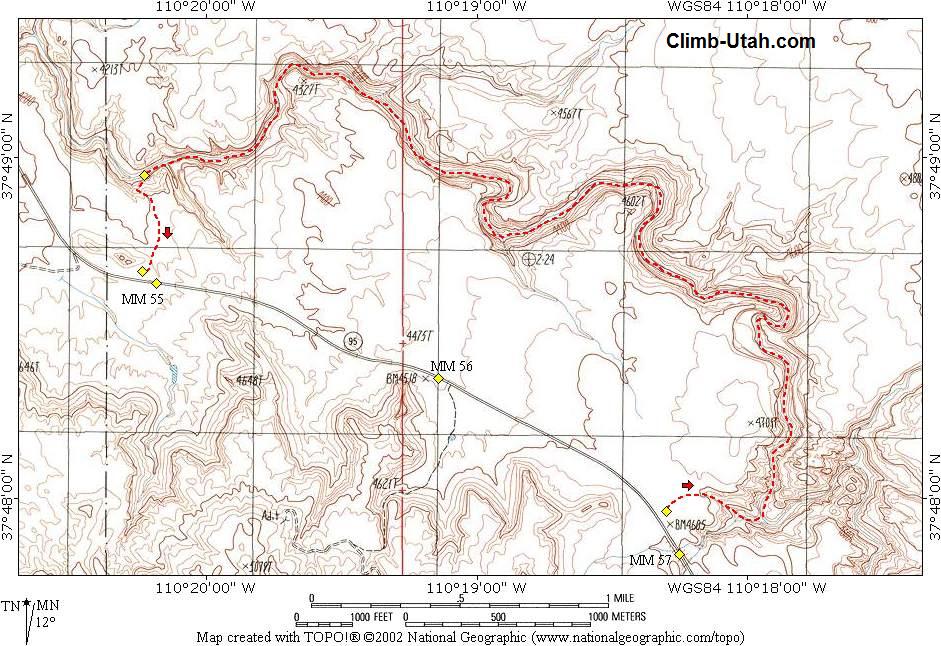
The trailhead is located next to a paved highway and is accessible to all vehicles in all weather conditions. From Blanding, Utah: Travel south on Utah Highway 191 for 3 miles to the junction of Utah Highway 191 and Utah Highway 95. Travel 64 miles west on Utah Highway 95 to mile marker 56.7. There is a large parking area on the north side of the road. This is the trailhead for the Black Hole. From Hanksville, Utah: Travel south on Utah Highway 95 for 57 miles to mile marker 56.7. There is a large parking area on the north side of the road. This is the trailhead for the Black Hole. Optional Shuttle: A shuttle vehicle will shorten the return hike by 2 miles or about 45 minutes. This shuttle is nicely suited for a bicycle because the shuttle route is along a paved highway. To set up your shuttle drive west on Highway 95 for 2 miles to milepost 54.7. There is a small parking area on the north side of the road. This is where you leave a shuttle if one is available.
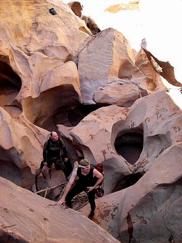
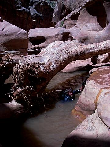
From the trailhead parking lot (N37° 47' 58", W110° 18' 18") follow the well defined trail north approximately 250 yards. Locate a side canyon, which leads east to the floor of White Canyon. There is usually a BLM sign warning of sure death somewhere in the vicinity of the side canyon. Scramble down the side canyon to the floor of White Canyon. There are no major obstacles in the side canyon. Follow White Canyon downstream. Don't bother trying to keep your shoes dry since they will be wet in a short distance despite your best effort. With careful route finding most obstacle's can be easily defeated with some ingenuity. The better you are at solving these minor problems the easier the route becomes. The first major drop can be by passed by downclimbing an easy to locate chimney on the left side or by climbing over the rocks on the right side. Both methods require a small amount of climbing skill. The second
major drop is best defeated by staying in the watercourse, but it can also be bypassed on
the south (left) side.
Related
Link:
Enjoy a short video of a trip through the Black Hole. If this video fails to play on your mobile device or computer you can always watch the Original YouTube Version here. © Copyright 2000-, Climb-Utah.com |