[ Homepage ] [ Introduction ] [ Warning ] [ Ratings ] [ Ethics ] [ Feedback ] [ Updates ]
General Information: All hikers in your party
should carry a minimum of two liters of water. Water is plentiful in this area, but all
water taken from lakes and streams should be filtered before drinking. Insect repellent is
a good idea as mosquito's can be bothersome during certain times of the year. A mosquito
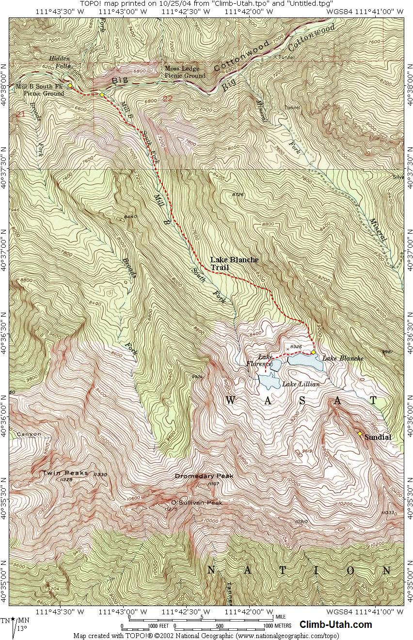
repellent that contains DEET (N,N-diethyl-m-toluamide) is highly recommended. Navigation for this route is easy. A GPS is useful in identifying waypoints and verifying your location. Good map reading skills and the USGS 7.5' Maps titled "Mount Aire" and "Dromedary Peak" are helpful. All waypoints and maps for this route use the WGS84 datum. It should be noted that due to new trail construction and trail realignment the USGS maps are not accurate in relation to trail location. The trails are correctly located on the map provided. Big Cottonwood Canyon is within Salt Lake City Watershed, therefore special restrictions apply and are strictly enforced. No domestic animals (dogs, cats, horses) are permitted in Big Cottonwood Canyon. During the winter months the Mill B area is a popular snowshoe destination. Avalanche danger should always be a major priority and proper precautions should be taken when enjoying Utah's winter wonderland. Trailhead Information: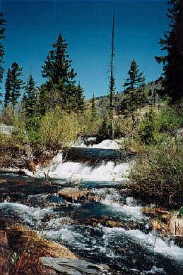 From anywhere in the Salt lake Valley take I-215 East until you reach the 6200 South Exit
(Exit 6). Signs are marked for the ski areas, you will be heading towards Brighton and
Solitude Ski Resorts. Drive east on 6200 south and the road will become Wasatch Boulevard.
Follow Wasatch Boulevard south to an intersection with Fort Union Boulevard (7200 South).
The intersection is located 1.7 miles after exiting I-215.
From anywhere in the Salt lake Valley take I-215 East until you reach the 6200 South Exit
(Exit 6). Signs are marked for the ski areas, you will be heading towards Brighton and
Solitude Ski Resorts. Drive east on 6200 south and the road will become Wasatch Boulevard.
Follow Wasatch Boulevard south to an intersection with Fort Union Boulevard (7200 South).
The intersection is located 1.7 miles after exiting I-215.All mileage is taken from the intersection of Wasatch Boulevard and Fort Union Boulevard. This is known locally as the "Mouth of Big Cottonwood Canyon". There is a large Park and Ride lot with restrooms located near the northeast corner of the intersection. From the intersection drive east up Big Cottonwood Canyon. After 4.4 miles you will reach the signed "Mill B Trailhead", which is located at what is locally known as the "Bottom of the S-Curve". There are two parking lots. The first is located to the south of the lower bend in the S-Curve. (the trailhead begins at the east end of this lot). The second is located to the east inside the upper bend of the S-Curve. The Mill B Trailhead is the beginning of several popular hikes and fills up early on weekends during periods of good weather. Route
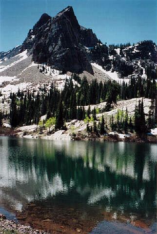
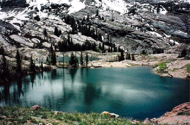
Information: From here it gets really simple. Just follow the well maintained trail for 2 3/4 miles to Lake Blanche (N40° 36' 23", W111° 41' 29"). The maintained trail ends at Lake Blanche, which is the highest of the three lakes in the cirque. Lake Florence and Lake Lillian should not be missed, and can be reached by following various footpaths west for 1/4 mile.
[ Homepage ] [ Introduction ] [ Warning ] [ Ratings ] [ Ethics ] [ Feedback ] [ Updates ] © Copyright 2000-, Climb-Utah.com |