[ Homepage ] [ Introduction ] [ Warning ] [ Ratings ] [ Ethics ] [ Feedback ] [ Updates ]
  Spry Canyon is a technical
canyoneering adventure that will require approximately 5 to 6 hours to complete.
Spry Canyon is rated 3B III using the Canyon Rating System. A car shuttle or hitch-hiking is required for this adventure.
Spry Canyon is a technical
canyoneering adventure that will require approximately 5 to 6 hours to complete.
Spry Canyon is rated 3B III using the Canyon Rating System. A car shuttle or hitch-hiking is required for this adventure.
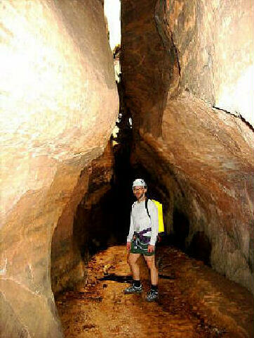
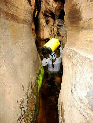
You will need complete technical gear along with two 50 meter (165-foot) ropes, several slings and a minimum of 50 feet of webbing. Spry Canyon requires knee to chest deep wading in several sections depending upon conditions. This canyon has multiple rappels, the longest being 150-feet. Once you begin descending this canyon please stay in the watercourse and help eliminate the problem of social trails circumventing obstacles. There is no need to leave the watercourse once you begin descending this canyon. The erosion problem created by social trails is a concern to the National Park Service. The watercourse offers more fun and adventure and helps reduce the erosion problem. Please practice responsible canyoneering. A GPS is useful. Good map reading skills and the USGS 7.5' Map titled "Springdale East" is necessary. Navigation for this adventure is moderate. All waypoints and maps for this route use the WGS84 datum. A Zion backcountry permit is required for this canyon. Spry Canyon has a moderate flash flood danger, check the weather report before attempting this route.
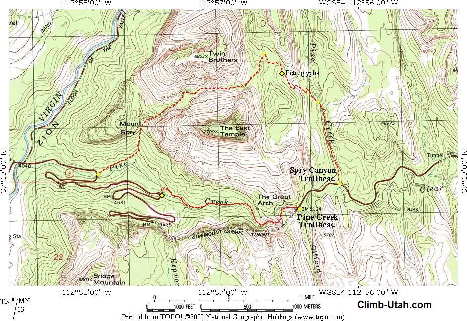
Stop at the visitor center and pick up a permit. Than take Highway 9 west from the visitors center towards the Zion-Mt. Carmel Tunnel. The Lower Trailhead is where Highway 9 crosses Pine Creek at the bridge. This is often referred to as the 1st switchback up Highway 9. If you have a shuttle vehicle this is where you want to leave it. If you don't have a shuttle vehicle it is usually easy to hitch a ride to the Upper Trailhead. To reach the Upper Trailhead, continue driving east on Highway 9. On your drive to the tunnel it is wise to stop and check out your exit route from Spry Canyon. A few moments memorizing the exit down the dirt cone and through the cliff bands will pay dividends at the completion of the route. Continue driving through the Zion-Mt. Carmel Tunnel. The moment you exit the Zion-Mt. Carmel Tunnel check your mileage. It is 0.4 miles from the tunnel exit to the Upper Trailhead. There are several large pull-outs just below the actual Upper Trailhead. There is no safe parking at the trailhead, please find a safe place to park where your vehicle will not be a nuisance.
From the trailhead (N37° 12' 56", W112° 56' 08") begin hiking north up the bottom of Pine Creek. Hike up canyon for 1/2 mile (15 minutes) to where the canyon begins to narrow (N37° 13' 25", W112° 56' 18"). Exit the canyon to the west and begin climbing up the slickrock taking the path of least resistance. The slickrock is steep in places but should be no problem if you carefully route find. Your target is the obvious pass between East Temple and Deertrap Mountain. As you near the pass there is a faded panel of petroglyphs (N37° 13' 35", W112° 56' 34") that contains a large number of figures. The petroglyphs are located on a 30-foot tall cliff that intersects your route to the pass. Once you reach the pass hike north along the ridge approximately one hundred yards until you can find and easy place to walk down into the canyon bottom (N37° 13' 42", W112° 56' 42"). From here it is all downhill to the Lower Trailhead. Follow the
canyon downstream. The first section of the canyon requires a small amount of bushwhacking
but is quite pretty with lush green vegetation contrasting with the red sandstone. Shortly
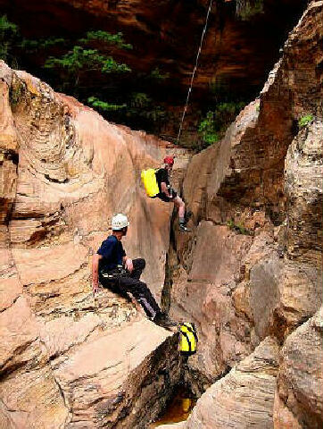
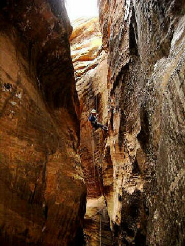
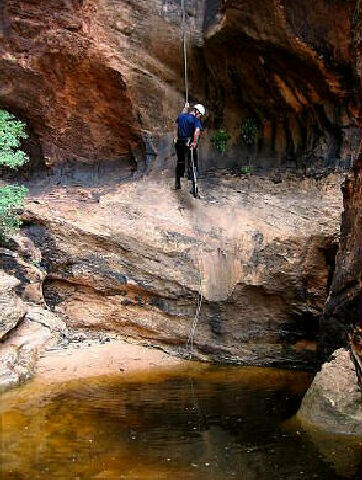
you will encounter a steep slickrock bowl with an easy to spot bolted rappel anchor near
the top. This is the longest rappel you will encounter at 165-feet. The anchor requires a
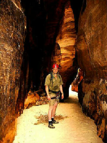
slight bit of downclimbing to reach but it is no problem. For the final section of the route the Zion Park Rangers have placed several signs restricting foot traffic towards the dirt cone to the west. The traill there is causing an erosion problem. Stay in the watercourse and follow the stone cairns down a fun scramble through the boulders. As you reach the end of the boulders you will find yourself at the top of an 85-foot cliff band. The anchor for this rappel is a large tree with webbing. From the bottom of the rappel it is a short hike down to Pine Creek. Follow the trail on the north side of Pine Creek to the Lower Trailhead (N37° 12' 59", W112° 57' 55").
[ Homepage ] [ Introduction ] [ Warning ] [ Ratings ] [ Ethics ] [ Feedback ] [ Updates ] © Copyright 2003-, Climb-Utah.com |