[ Homepage ] [ Introduction ] [ Warning ] [ Ratings
] [ Ethics ] [ Feedback ] [ Updates
]
 |
Lion's Mouth Cave
Cedar City
Pictographs & Hiking
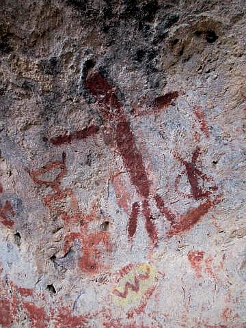
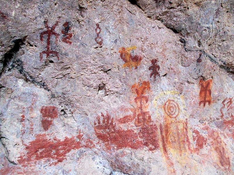
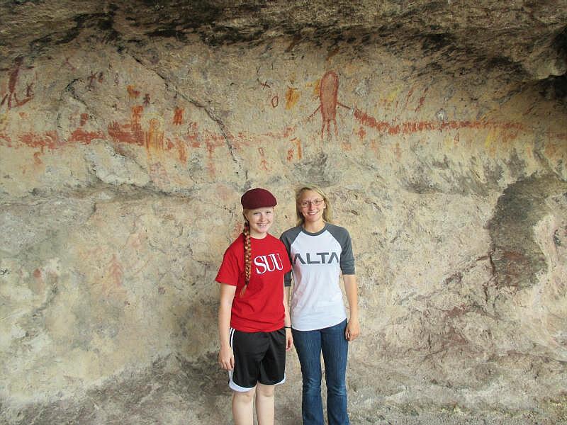
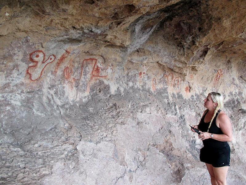
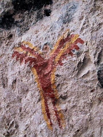
Lion's
Mouth Cave contains numerous pictographs painted along the walls of an
overhanging cave. The panel of rock art contains several anthropomorphic
figures, a snake like figure, and numerous other drawings. The figures
are painted with red and yellow hues.
|
General Information:
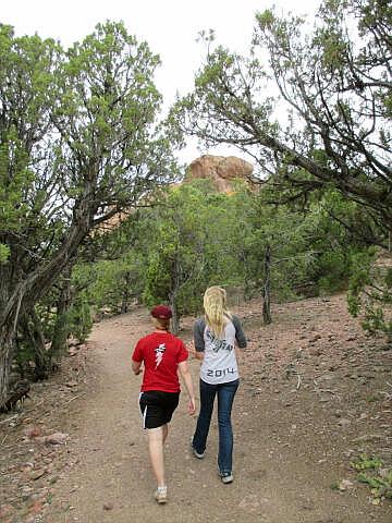
  Visiting the Lion's Mouth Cave Pictographs requires a short 1/4 mile hike. A trip to the
rock art requires about one hour round trip and is suitable for the entire
family. Lion's Mouth Cave is rated 1A I using the Canyon
Rating System. The rock art is accessible year round, but the last 50-feet
of slickrock might be difficult with snow on the ground. This is an excellent
destination for those with a little extra time in the Cedar City Area.
Lion's Mouth Cave was named due to its distinctive appearance of looking
like the mouth of a Lion.
Visiting the Lion's Mouth Cave Pictographs requires a short 1/4 mile hike. A trip to the
rock art requires about one hour round trip and is suitable for the entire
family. Lion's Mouth Cave is rated 1A I using the Canyon
Rating System. The rock art is accessible year round, but the last 50-feet
of slickrock might be difficult with snow on the ground. This is an excellent
destination for those with a little extra time in the Cedar City Area.
Lion's Mouth Cave was named due to its distinctive appearance of looking
like the mouth of a Lion.
Navigation
for this route is simple as the route follows an easy to identify trail. A GPS is
helpful but not required. The USGS 7.5' Maps titled "Page Ranch" and
"Stoddard Mountain" show the area described. All waypoints and maps
use the WGS84 datum.
Trailhead Information:
When traveling
through Cedar City take I-15 Exit 59. Head west on Highway 56 for 16.7 miles
to Pinto Road (N37° 36' 28", W113° 21' 31") located on the south (left) side
of the highway. Pinto Road is a signed and well-maintained dirt road. Follow
Pinto Road west for 1.2 miles to the Lion's Mouth Trailhead. The trailhead
is identified as a pull-out that will accommodate several vehicles on the
north (right) side of the road. The trailhead can
easily be reached by passenger vehicles in dry weather conditions.
Route Information:
From the
Lion's Mouth Trailhead (N37° 35' 50", W113° 22' 34") follow the trail that
begins at the gate on the north side of the vehicle pull-out. Follow the
trail as it switchbacks at first to gain elevation and than contours in a
northwest direction to a large rock formation. The Lion's Mouth Pictographs
(N37° 35' 48", W113° 22' 47") are on the west side of the rock formation in
a large alcove. The rock art is easy to locate. The total approach from
trailhead to rock formation is approximately 1/4 mile.
Take only pictures and leave only footprints.
[ Homepage
] [ Introduction ] [ Warning ] [ Ratings ] [ Ethics
] [ Feedback ] [ Updates ]
© Copyright
2000-, Climb-Utah.com |