[ Homepage ] [ Introduction ] [ Warning ] [ Ratings ] [ Ethics ] [ Feedback ] [ Updates ]

 Angels Landing is a thrilling hike that contains no obstacles. The route is 2 1/4 miles
from trailhead to summit and will require 2 to 3 hours for a round trip. This hike can be
very hot during midday. Every member of your party should carry a minimum of one liter of
water. Angels Landing is a thrilling hike that contains no obstacles. The route is 2 1/4 miles
from trailhead to summit and will require 2 to 3 hours for a round trip. This hike can be
very hot during midday. Every member of your party should carry a minimum of one liter of
water.
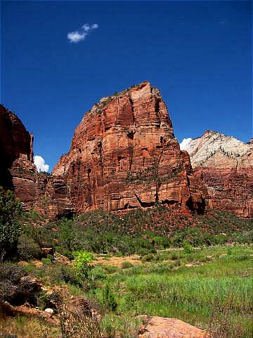
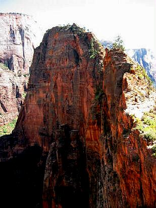
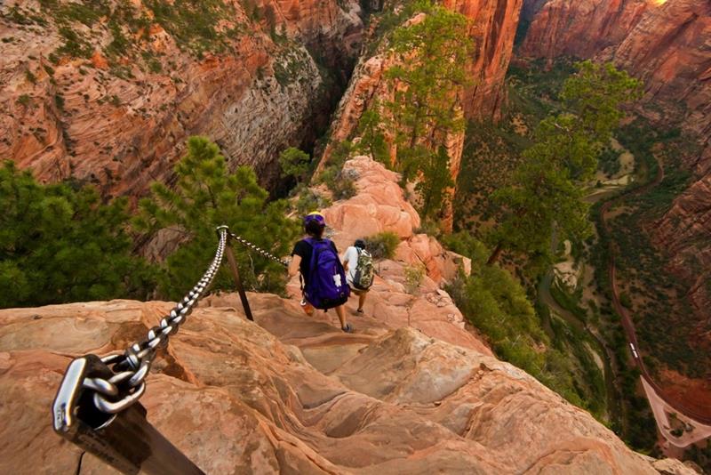
The route to Angels Landing involves travel along a steep, narrow ridge with major cliffs.
Support chains are anchored intermittently along the last 1/2 mile of the route for
safety. Do not hike this route if it is wet, icy or thunderstorms are in the area. This is
not a trail suitable for young children. Older children must be closely supervised. Anyone
lacking commonsense should avoid this hike. Permits:
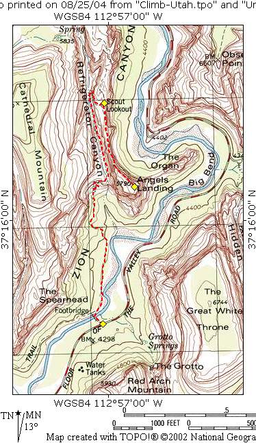
From the main Zion Canyon Visitor's Center take the Zion Canyon Shuttle to the Grotto Picnic Area located in Zion Canyon. This trailhead is also the start of the very popular West Rim Trail. Route Information: From the Grotto Picnic Area (N37° 15' 34", W112° 57' 02") follow the footbridge east across the Virgin River. On the east side of the bridge the trail tee's. The south (left) trail leads to the Emerald Pools. Take the north (right) trail signed West Rim and Angels Landing. Follow the paved West Rim Trail towards Angels Landing. The route snakes up Refrigerator Canyon and climbs the famous Walter's Wiggles to Scouts Lookout (N37° 16' 30", W112° 57' 01"). The trail divides here with the the north (left) fork leading to the West Rim and the south (right) fork leading to Angel's Landing (N37° 16' 09", W112° 56' 52"). There is a restroom located at Scouts Lookout. The last 1/2 mile of the Angels Landing Tail follows a narrow ridge for 1/2 mile. The trail looks much more intimidating than it actually is. The ridge is not that difficult and there are chains to use as handrail where required.
[ Homepage ] [ Introduction ] [ Warning ] [ Ratings ] [ Ethics ] [ Feedback ] [ Updates ] © Copyright 2000-, Climb-Utah.com |