[ Homepage ] [ Introduction ] [ Warning ] [ Ratings ] [ Ethics ] [ Feedback ] [ Updates ] White Pine Lake Little Cottonwood Canyon Wasatch Mountains Hiking and Mountaineering White Pine Canyon has long been the subject of intense controversy between advocates of wilderness and ski resort owners. The original boundaries of Lone Peak Wilderness Area, created in 1977, were meant to include White Pine Canyon, but lobbyists representing Snowbird Ski Resort succeeded in having White Pine Canyon excluded. Hike this fantastic canyon and discover why everyone wants it. This trail is open to mountain bikes but they are extremely rare. This is an easy hike but a real grind on a mountain bike.
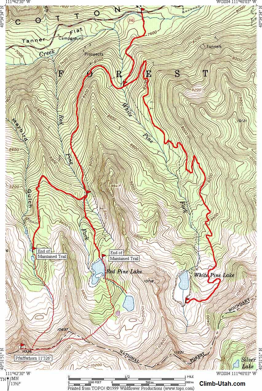
Length: 4 1/2 miles - One Way to White Pine Lake. Time: 2 1/2 hours - One Way to White Pine Lake. Trailhead: 7,650' White Pine Lake: 10,000' Skill Rating: Easy, there is nothing difficult. Season: Late Spring, Summer and Fall. Equipment: Trekking poles or iceaxe in early summer. Water: 2 liters per person. Difficulties: Snow possible on route to mid-summer. Navigation: Extremely easy. Circle Trip: No. Warnings: The trail might require crossing snow until mid-summer.
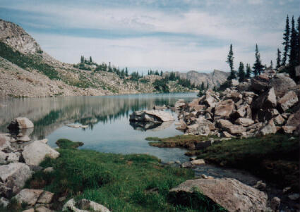
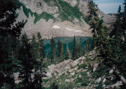
From I-15 in Sandy, Utah take Exit #298 (9000 South) and head east on Highway 209 (9000 South) for 6.9 miles at which point Highway 209 joins Highway 210 (Little Cottonwood Canyon Road) at a Y-Junction. All mileage in this canyon is measured from this Y-Junction. The junction is identified be a huge flashing message board on the south side of the road and a park and ride lot on the north side of the canyon. The park and ride lot has a restroom. The White Pine Trailhead is located 5 1/2 miles up Little Cottonwood Canyon from the Y-Junction and 3/4 mile below Snowbird Ski Resort on the south side of the road. The Trailhead is signed with paved parking, vault toilet and information kiosk. Route Information:The trail to White Pine Lake follows an old 4-wheel drive track that was built to service the damn and mining claims. The Forest Service no longer allows motor vehicles in the area, however mountain bikes are still allowed in the White Pine drainage. The hike starts at the White Pine Trailhead and is suitable for beginners. The trail is well maintained and signed. A paved path leads from the parking area to a footbridge over Little Cottonwood Creek. One hundred yards after crossing the footbridge the trail forks. The right fork leads down to a stream side meadow, take the left fork, which climbs upward into White Pine Canyon. One mile from the trailhead the trail meets the stream in White Pine Canyon. The trail to Red Pine Lake and Maybird Gulch crosses the stream, If you cross the stream you are on the wrong trail. The trail to White Pine Lake stays on the old 4-wheel drive track and heads east away from the stream. The trail encounters a large switchback, turns south, and continues its wandering course towards the lake. The trail passes through several picturesque meadows. As you near the lake the trail makes several switchbacks up the east side of White Pine Cirque and then traverses westward along the talus slopes to where the lake is visible. The trail than drops 120 feet into a basin where the lake is located. [ Homepage ] [ Introduction ] [ Warning ] [ Ratings ] [ Ethics ] [ Feedback ] [ Updates ] © Shane Burrows, all rights reserved |