[ Homepage ] [ Introduction ] [ Warning ] [ Ratings ] [ Ethics ] [ Feedback ] [ Updates ]
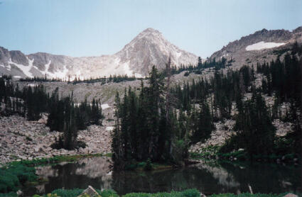
 The Pfeifferhorn is located in the most isolated part
of the Lone Peak Wilderness Area. There is no easy route to the summit, all approaches
involve a minimum of 4 1/2 miles of trekking and over 3700' of elevation gain. A round
trip from the White Pine trailhead to the summit requires a minimum of 7 1/2 hours in
summer under ideal conditions. Expect your adventure to be longer in winter depending
on snow conditions.
The Pfeifferhorn is located in the most isolated part
of the Lone Peak Wilderness Area. There is no easy route to the summit, all approaches
involve a minimum of 4 1/2 miles of trekking and over 3700' of elevation gain. A round
trip from the White Pine trailhead to the summit requires a minimum of 7 1/2 hours in
summer under ideal conditions. Expect your adventure to be longer in winter depending
on snow conditions.
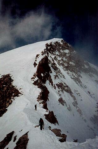
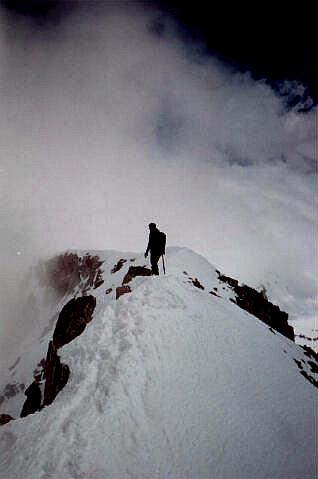
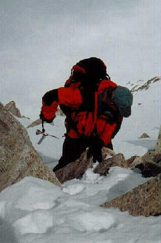
If climbing in winter or spring, I recommend an early start to take advantage of firm morning snow conditions. A winter accent is a fantastic mountaineering experience requiring the use of crampons and ice axe. You should know how to perform a self arrest with your ice axe before attempting this climb. You will be traversing a spectacular 1/4 mile long, knife edged ridge. Sliding towards a cliff is the wrong time to try and master the skill of self arrest. During the winter months this area is a popular snowshoe and cross country skiing destination. Avalanche danger should always be a major priority and proper precautions should be taken when enjoying Utah's winter wonderland.
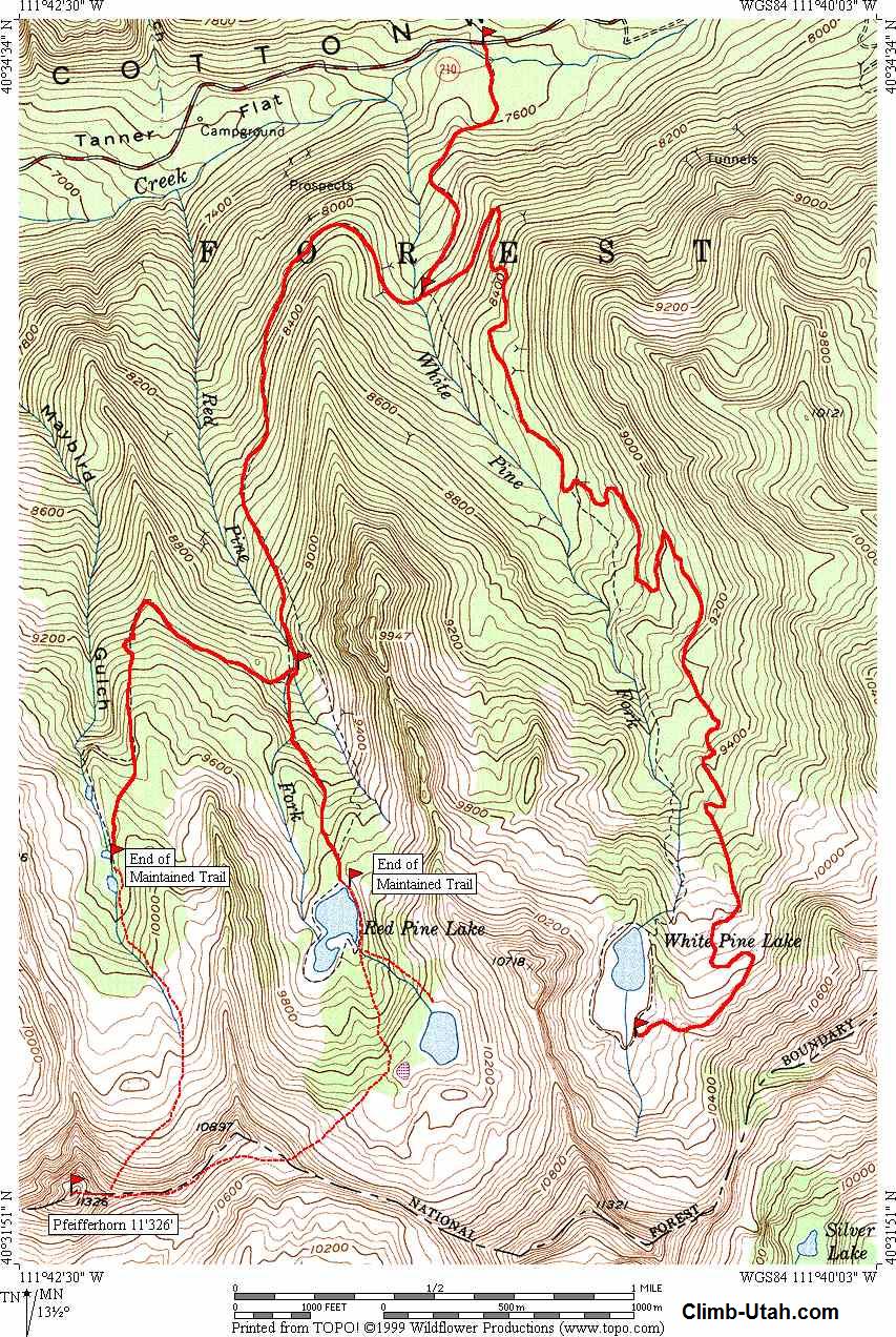
From I-15 in Sandy, Utah take Exit #298 (9000 South) and head east on Highway 209 (9000 South) for 6.9 miles at which point Highway 209 joins Highway 210 (Little Cottonwood Canyon Road) at a Y-Junction. All mileage in this canyon is measured from this Y-Junction. The junction is identified be a huge flashing message board on the south side of the road and a park and ride lot on the north side of the canyon. The park and ride lot has a restroom. The White Pine Trailhead is located 5 1/2 miles up Little Cottonwood Canyon from the Y-Junction and 3/4 mile below Snowbird Ski Resort on the south side of the road.
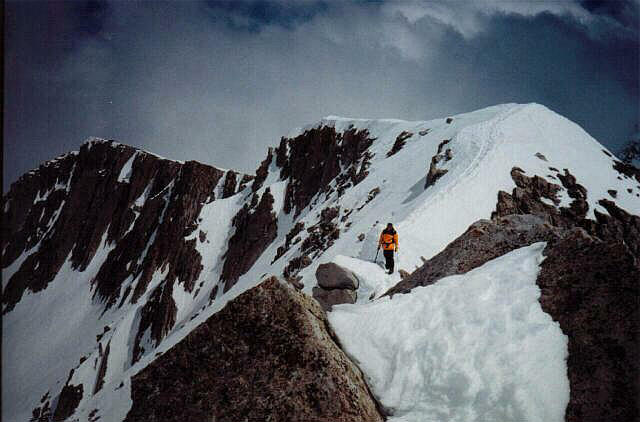
Begin at the White Pine Trailhead in Little Cottonwood Canyon. Take the trail to Red Pine Lake, continue to Upper Red Pine Lake. Look for the minor ridge heading southwest from Upper Red Pine Lake to Alpine Ridge. Your target is the junction on Alpine Ridge where Red Pine, Maybird and Dry Creek canyons join. The headwall leading to Alpine Ridge is very steep and there will be a cornice at the top in winter and early spring. Using this minor ridge to gain access to Alpine Ridge is an easier variation of the standard scrambling route which heads for the low point in the saddle at the base of White Baldy. This minor ridge is accessible to both summer and winter climbers. From Alpine Ridge the Pfeifferhorn summit is unmistakably visible to the west. Traverse Alpine Ridge to the summit of the Pfeifferhorn. You can create a loop trip by descending Maybird Gulch, The upper talus fields in Maybird are very difficult to cross if they are not snow covered. It is also possible to climb the Pfeifferhorn from Maybird, but it is a more difficult route.
[ Homepage ] [ Introduction ] [ Warning ] [ Ratings ] [ Ethics ] [ Feedback ] [ Updates ] © Copyright 1999-, Climb-Utah.com |