[
Homepage ] [
Introduction ] [
Warning ] [
Ratings
] [ Ethics ] [
Feedback ] [
Updates ]
 |
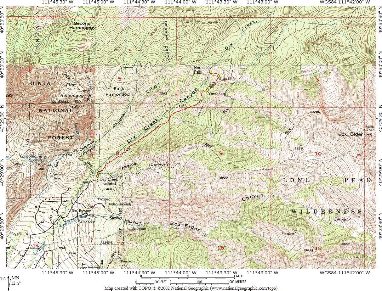
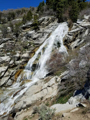
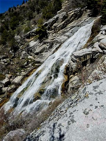
Horsetail Falls
Dry Creek Canyon
Wasatch Mountains
Hiking
Horsetail
falls is a fun hike close to the Wasatch Front that is suitable for the family.
The views of the waterfall in spring and early summer are magnificent. |
General Information:
  The hike to Horsetail Falls is a great way to spend half a day. The hike is
approximately 2 miles each way with 1600 feet of elevation gain. A round
trip hike will require 3 to 4 hours. This adventure is accessible year round, but
spring and early summer are the preferred season. Visiting the waterfall
during spring runoff is the ideal time of year. Everyone in your group
should carry at least one liter of water. The hike is pretty well shaded in
the morning as it climbs through the pine forest.
The hike to Horsetail Falls is a great way to spend half a day. The hike is
approximately 2 miles each way with 1600 feet of elevation gain. A round
trip hike will require 3 to 4 hours. This adventure is accessible year round, but
spring and early summer are the preferred season. Visiting the waterfall
during spring runoff is the ideal time of year. Everyone in your group
should carry at least one liter of water. The hike is pretty well shaded in
the morning as it climbs through the pine forest.
A GPS is not really
required, but does allow you to verify your position. The USGS 7.5' Map
titled "Timpanogos Cave" shows the area
described. The USGS map is out of date and the roads and trails in the area
are not shown correctly. Navigation for this route is easy if you follow the
route description provided. The hike to Horsetail Falls is rated
1A II using the Canyon
Rating System.
Trailhead Information:
From Main Street and
200 North in Alpine Utah. Turn east on 200 North and drive 0.2 miles to
Grove Drive (200 East). Turn Left on Grove Drive. Follow Grove Drive for 1.8
miles to a Tee in the road. Turn right, and then immediately turn left.
Follow the road for 0.6 miles to where it ends at the signed Dry Creek
Trailhead. The large parking lot will accommodate two dozen vehicles. There
are no toilets at the trailhead..
 |
 |
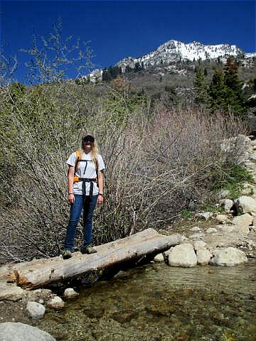
Route Information:
From the Dry
Creek
Trailhead (N40° 28' 58", W111° 45' 01"), follow the obvious trail
east as it begins climbing up Dry Creek Canyon. This trail is easy to follow and
it's almost impossible to get lost. Just keep hiking up the most well
traveled trail. After hiking for 1 3/4 miles you will reach a viewpoint
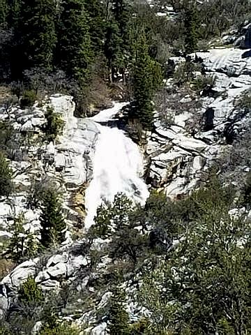
(N40° 29' 46", W111° 43' 41"), that offers a good look at Horsetail
Falls. From the viewpoint continue hiking up the trail for 1/4 mile until
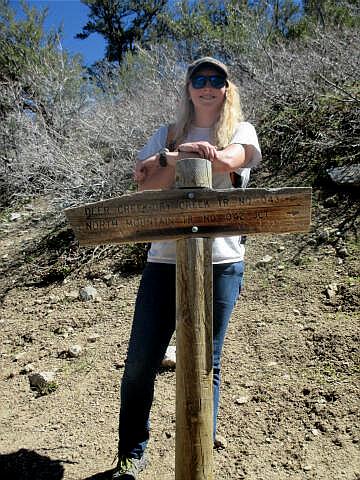
you reach a signed junction in the trail (N40° 29' 54", W111° 43' 33").
Turn left (north) at the junction and follow the wide main trail for
20-yards to where a spur trail splits off to the left (North). There are
many ways to reach the actual waterfall, but this spur trail is one of the
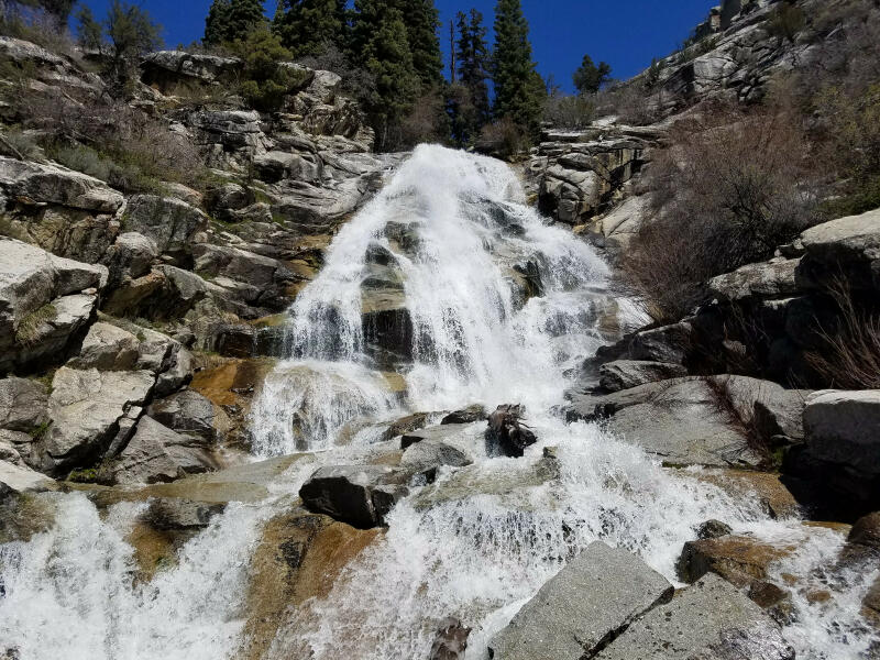
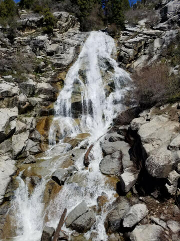
easiest and a short 300-yard hike takes you to the base of Horsetail Falls
(N40° 29' 56", W111° 43' 38"). The most impressive views of the
waterfall are from the base.
Please take only pictures and leave
only footprints.
Video:
Enjoy a short video
of a hike to Horsetail Falls in Dry Creek Canyon. The Video was taken May 5,
2017 during the height of spring runoff.
[
Homepage
] [ Introduction ] [
Warning ] [
Ratings ] [
Ethics
] [ Feedback ] [
Updates ]
© Copyright
2000-, Climb-Utah.com |