[ Homepage ] [ Introduction ] [ Warning ] [ Ratings ] [ Ethics ] [ Feedback ] [ Updates ]
General Information: All hikers in your party
should carry a minimum of one liter of water. Water is plentiful in this area, but all
water taken from lakes and streams should be filtered before drinking. You will pass a
spring one the way to the lake that provides an opportunity to refill water bottles.
Insect repellent is a good idea as mosquitos can be bothersome during certain times of the
year. A mosquito repellent that contains DEET (N,N-diethyl-m-toluamide) is highly
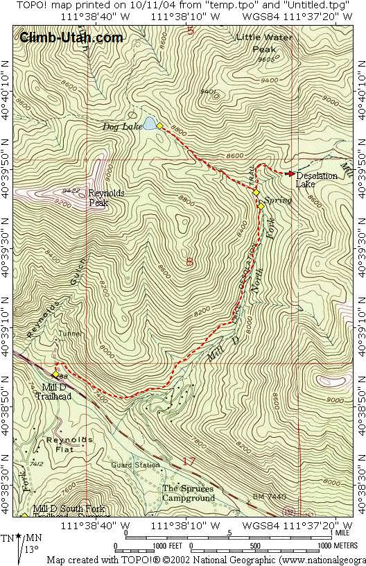
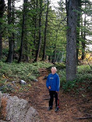
recommended. Navigation for this route is easy. A GPS is useful in identifying waypoints and verifying your location. Good map reading skills and the USGS 7.5' Map titled "Mount Aire" is helpful. All waypoints and maps for this route use the WGS84 datum. It should be noted that due to new trail construction and trail realignment the USGS maps are not accurate in relation to trail location. The trails are correctly located on the map provided. Big Cottonwood Canyon is within Salt Lake City Watershed, therefore special restrictions apply and are strictly enforced. No domestic animals (dogs, cats, horses) are permitted in Big Cottonwood Canyon. During the winter months the Mill D area is a popular snowshoe destination. Avalanche danger should always be a major priority and proper precautions should be taken when enjoying Utah's winter wonderland.
From anywhere in the Salt lake Valley take I-215 East until you reach the 6200 South Exit (Exit 6). Signs are marked for the ski areas, you will be heading towards Brighton and Solitude Ski Resorts. Drive east on 6200 south and the road will become Wasatch Boulevard. Follow Wasatch Boulevard south to an intersection with Fort Union Boulevard (7200 South). The intersection is located 1.7 miles after exiting I-215. All mileage is taken from the intersection of Wasatch Boulevard and Fort Union Boulevard. This is known locally as the "Mouth of Big Cottonwood Canyon". There is a large Park and Ride lot with restrooms located near the north east corner of the intersection. From the intersection drive east up Big Cottonwood Canyon. After driving 9.1 miles you will reach the signed "Mill D Trailhead". This is a large paved parking lot located on both the north and south side of the road. Information kiosks are located on both sides of the road. A toilet is located next to the south side parking lot. The Mill D Trailhead is the beginning of several popular hikes.
Route
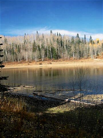
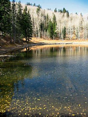
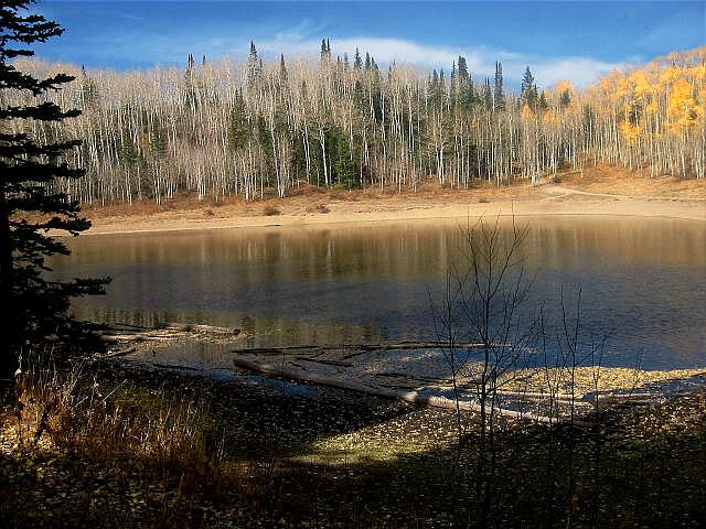
Information: 150 yards after you pass the spring you will encounter a signed junction (N40° 39' 44", W111° 37' 47"). The trail to the east (right) goes to Desolation Lake. Follow the trail to the west (left) towards Dog Lake. From the junction the trail climbs 1/2 mile to Dog Lake (N40° 40' 01", W111° 38' 19").
Optional Information: [ Homepage ] [ Introduction ] [ Warning ] [ Ratings ] [ Ethics ] [ Feedback ] [ Updates ] © Copyright 2000-, Climb-Utah.com |