[ Homepage ] [ Introduction ] [ Warning ] [ Ratings ] [ Ethics ] [ Feedback ] [ Updates ]
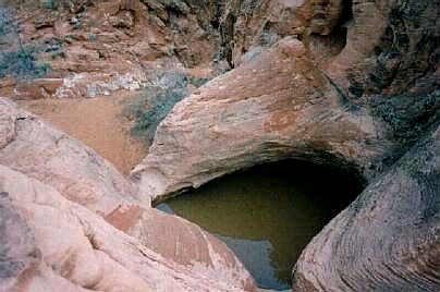
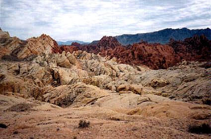
In 1935, Valley of Fire was scheduled to become one of four original State Parks. Eager local officials jumped the gun and held a celebration on Easter Sunday of 1935, which resulted in Valley of Fire becoming Nevada's first state park, it is also the largest. The rough floor and jagged walls of the park contain brilliant formations of eroded sandstone and sand dunes more than 150 million years old. These features, which are the centerpiece of the park's attractions, often appear to be on fire when reflecting the sun's rays. Local Legend - Mouse's Tank: One of the great legends of Valley of Fire is about a Paiute Indian named Mouse. Mouse was a known outlaw who worked on a ferry that crossed the Colorado River. After a drunken episode where he shot up an Indian camp his employers fired him and dumped him off in Arizona. There, it is said, he killed two prospectors. An intensive search was conducted but Mouse could not be found. Apparently during these episodes Mouse would flee to the Valley of Fire to hide out. Here he would sometimes use "Mouse's Tank", a depression in the rocks that catches and holds rainwater for up to 6 months after a storm. Mouse's Tank is well hidden within the maze of rock formations in Petroglyph Canyon, a perfect hideout for a fugitive. On July 11, 1897 a posse tracked Mouse near Muddy Spring and ordered him to surrender. Mouse would not give up and after a gunfight with the law Mouse was shot and killed.
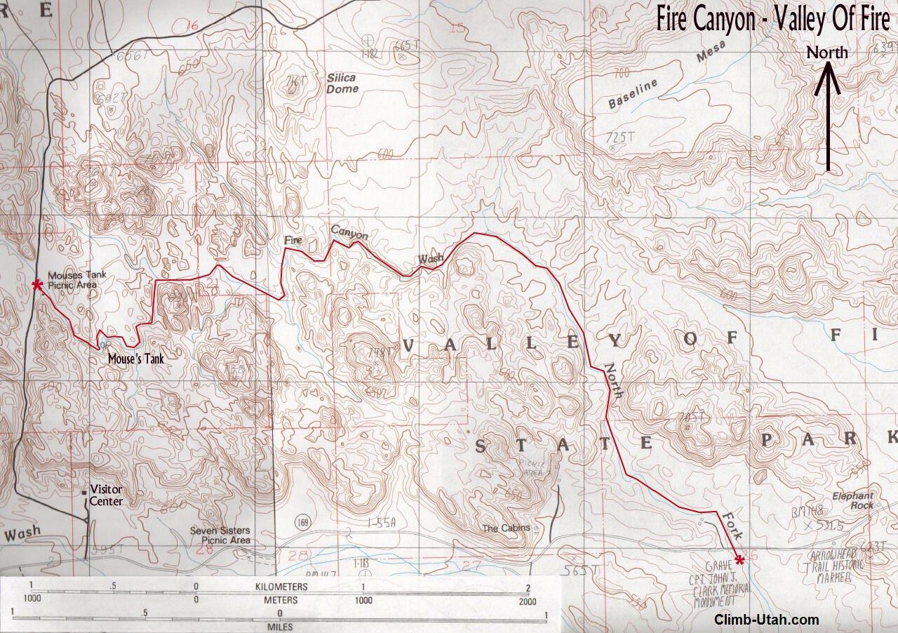
From the Valley of Fire Visitors Center return 1/4 mile to SR 169. From the junction with Visitor Center road and SR 169 travel 2 1/2 miles east to the Clark Memorial Monument, which is located on the south side of SR 169. There is a turnout for several cars, a monument with a white cross and several interpretive signs. This is your exit point and the place where you want to leave a car. Return to the junction of Visitor Center road and SR 169. From the junction follow the Visitor Center Road 1 1/4 miles north to the signed Petroglyph Canyon / Mouse's Tank Trailhead.
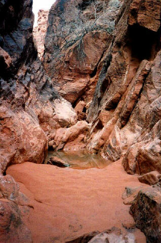
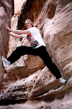
From the Petroglyph Canyon / Mouse's Tank Trailhead, follow the signed tourist route 1/4 mile through Petroglyph Canyon to Mouse's Tank. Enjoy the numerous rock art panels along the way. At Mouse's Tank, which is two large potholes blocking the canyon you will lose most the tourists. Bypass the tanks by climbing a ledge system to the left LDC (looking down canyon). Follow the canyon downstream scrambling over obstacles along the route. Approximately 3/4 mile from Mouse's Tank you will encounter a large chokestone which most people need a rope for assistance to downclimb (10-foot high). This chokestone blocks casual hikers who continued beyond the tanks. 1/4 mile below the chokestone you will encounter a 40' dry fall. This can be rappelled if you brought technical gear or it can be bypassed by climbing into the draw to the left LDC and downclimbing (very easy, no exposure). From here on just follow the canyon downstream. There are plenty of side canyons which you can explore. One side canyon in particular is a deep narrow slot only two feet wide which has a large chokestone guarding the entrance which you must climb past to visit. If a car spot is not an option it is possible to backtrack your route. You might want to leave a rope hanging at the large chokestone if climbing it on the return will be a problem. I have piled rocks at the base until I could reach the top when backtracking. Navigation in the reverse direction is very difficult unless you have just traveled the route and are familiar with it. [ Homepage ] [ Introduction ] [ Warning ] [ Ratings ] [ Ethics ] [ Feedback ] [ Updates ] © Copyright 2000, Shane Burrows |