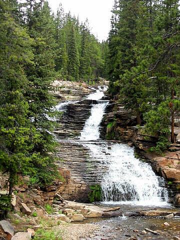
 The Provo River Waterfalls
are something everyone can enjoy. Pack a picnic and spend the afternoon admiring the
river. A very short Improved trail lead to the waterfalls making this roadside stop
accessible to everyone.
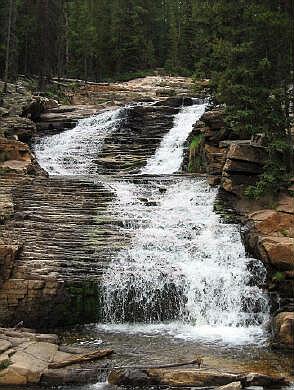
The Provo River Waterfalls
are something everyone can enjoy. Pack a picnic and spend the afternoon admiring the
river. A very short Improved trail lead to the waterfalls making this roadside stop
accessible to everyone.
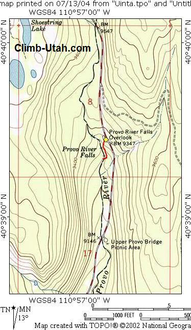
Afternoon thunderstorms are very common in the high Uinta Mountains so go prepared with rain gear. Because of the high precipitation mosquito's are common in the Uinta's. A mosquito repellent that contains DEET (N,N-diethyl-m-toluamide) is most effective. There is no navigation required for this route. The USGS 7.5' Map titled "Mirror Lake" shows the section of Provo River with the waterfalls. All waypoints and maps for this adventure use the WGS84 datum. Use
Fee: Fishing:
Trailhead
Information: From Evanston, Wyoming follow Highway 150 south for 54 miles to the signed Provo River Falls parking area located at mile marker 23.9. The parking lot is paved and contains an information kiosk and a pit toilet. Any vehicle can access this parking lot. Improved campgrounds are located nearby at both Trial Lake and Washington Lake. Route Information:There is no route. From the parking area (N40° 39' 27", W110° 56' 44") walk east a hundred feet on the improved trail to one of several vantage spots along the river. Than kick back and relax. © Copyright 2000-, Climb-Utah.com |