 Hayden Peak is for
experienced hikers only. The route contains some scrambling and exposure. The hike to the
summit can be completed in 4 to 5 hours round trip. The trail gains 2100 feet of elevation
a little over 2 miles. All hikers in your party should carry a minimum of one liter of
water.
Hayden Peak is for
experienced hikers only. The route contains some scrambling and exposure. The hike to the
summit can be completed in 4 to 5 hours round trip. The trail gains 2100 feet of elevation
a little over 2 miles. All hikers in your party should carry a minimum of one liter of
water.
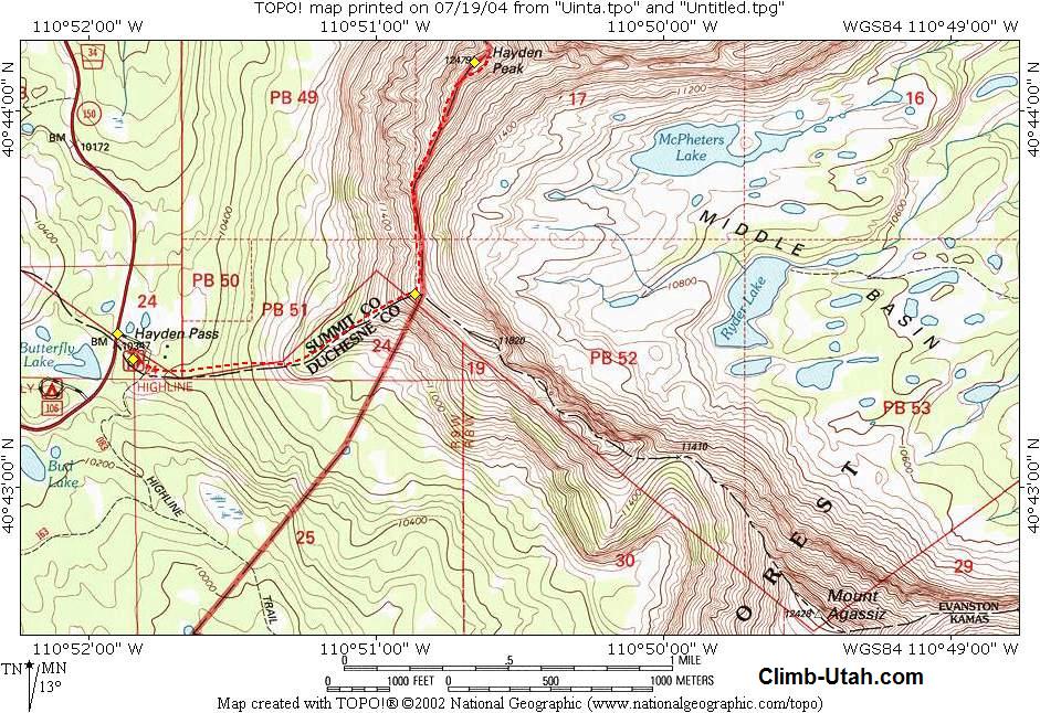
The Hayden Peak route hike is rated 3 III using the Yosemite Decimal System. Afternoon thunderstorms are very common in the high Uinta Mountains so go prepared with rain gear. Because of the lightening that often attacks this summit it is highly advised that you avoid this hike during stormy weather. Mosquito's are common in the Uinta's. A mosquito repellent that contains DEET (N,N-diethyl-m-toluamide) is most effective. This hike can be dangerous during Spring and early Summer (before July 15th) because portions of the route will still be snow packed and extremely slippery. Navigation for this route is moderate. There is no trail and basic route finding is required through several cliff bands. A GPS is really not required but I'll still supply the waypoints for the computer nerds. The USGS 7.5' Map titled "Hayden Peak" is helpful. All waypoints and maps for this route use the WGS84 datum. Use
Fee:
Trailhead
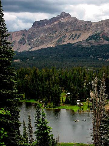
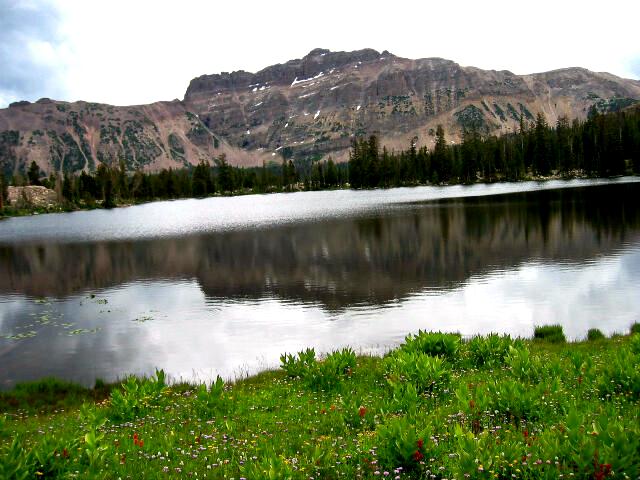
Information: From Evanston, Wyoming follow Highway 150 south for 44 miles to the signed Highline Trailhead located at mile marker 34.2. The large parking area Highline Trailhead contains an information kiosk and a pit toilet. Improved campgrounds are located nearby at both Butterfly Lake and Mirror Lake. Both of these campgrounds offer impressive views of Hayden Peak Mountain. Any vehicle can access this trailhead. Route Information:The route begins at the Highline Trailhead (N40° 43' 21", W110° 51' 51") but does not use an existing trail. The Highline Trailhead is just a convenient place to park. From the trailhead you should be able to look east and see a spur ridge leading up to the ridge running between the summit of Hayden Peak to the north and Mount Agassiz to the south. The object is to climb up the spur ridge to the main Hayden/Agassiz Ridge. The spur ridge is is easiest if you generally stay on top of the ridge. You will encounter several small cliff bands that you must route find and scramble through. These are not difficult if you look around for a reasonable route. In places you might encounter a faint track from previous hikers. After a bit of climbing you will reach the junction of the spur ridge and Hayden/Agassiz Ridge (N40° 43' 31", W110° 50' 52"). At this junction you should have some great views. At this junction turn north and follow the main ridge towards the Summit of Hayden Peak. You will be boulder hopping along some of the ridge until you approach the gendarme (minor peak guarding the way). As you approach the gendarme the route becomes steep and you must pass to the west of the gendarme and than scramble back up to regain the ridge. There is loose rock and exposure in this area, use caution and commonsense. After you regain the ridge the best route passes under the actual summit on the east side and than climbs the north ridge to the summit of Hayden Peak (N40° 44' 08", W110° 50' 40"). Return the way you came. © Copyright 2000-, Climb-Utah.com |